
UTMT Martin, TN - Earthquake Result Viewer
| ||||||||||||||||||
| ||||||||||||||||||
| ||||||||||||||||||
|
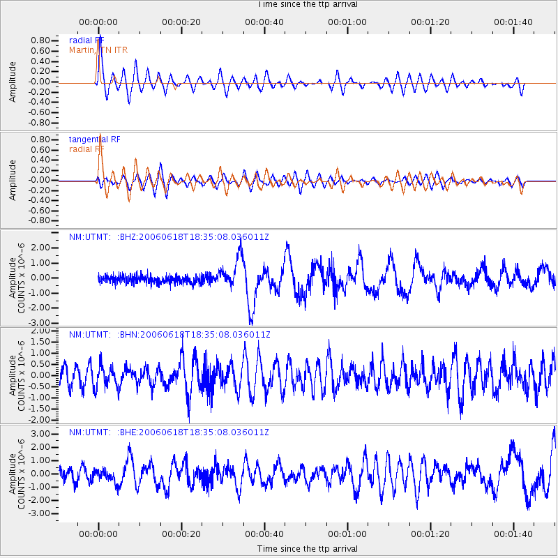
Signal To Noise
| Channel | StoN | STA | LTA |
| NM:UTMT: :BHN:20060618T18:35:08.036011Z | 1.0170703 | 4.981459E-7 | 4.897851E-7 |
| NM:UTMT: :BHE:20060618T18:35:08.036011Z | 1.2401875 | 4.879705E-7 | 3.934651E-7 |
| NM:UTMT: :BHZ:20060618T18:35:08.036011Z | 4.5248265 | 1.0823061E-6 | 2.3919284E-7 |
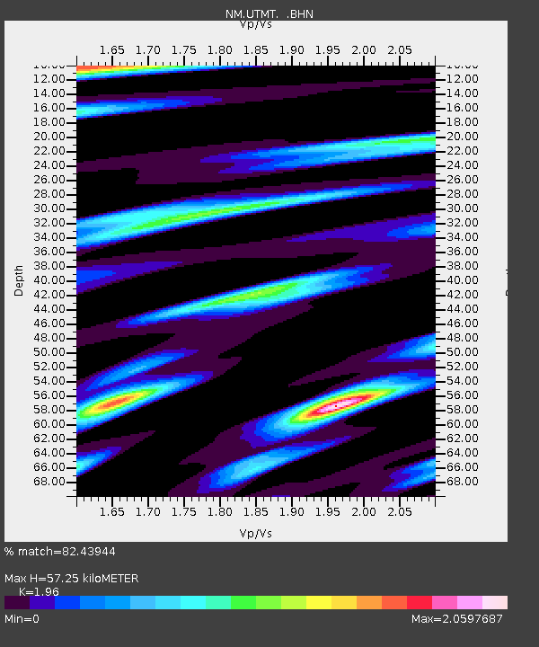
| Arrivals | |
| Ps | 9.1 SECOND |
| PpPs | 25 SECOND |
| PsPs/PpSs | 34 SECOND |

