UTMT Martin, TN - Earthquake Result Viewer
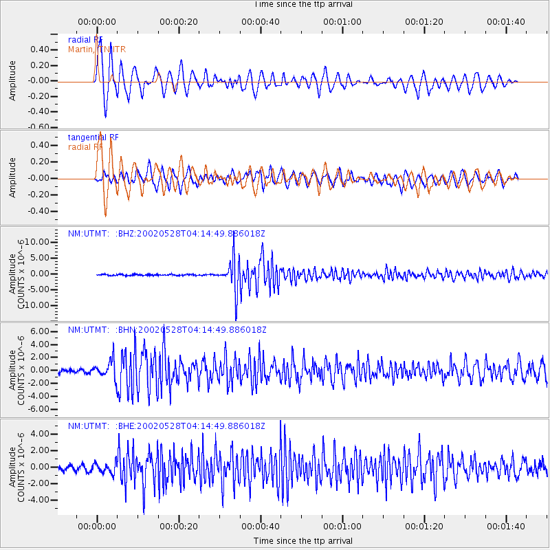
Earthquake location: Catamarca Province, Argentina
Earthquake latitude/longitude: -28.9/-66.8
Earthquake time(UTC): 2002/05/28 (148) 04:04:22 GMT
Earthquake Depth: 22 km
Earthquake Magnitude: 6.0 MB, 5.7 MS, 6.0 MW, 5.9 MW
Earthquake Catalog/Contributor: WHDF/NEIC
Network: NM Cooperative New Madrid Seismic Network
Station: UTMT Martin, TN
Lat/Lon: 36.34 N/88.86 W
Elevation: 120 m
Distance: 68.2 deg
Az: 340.928 deg
Baz: 159.223 deg
Ray Param: 0.056452703
Estimated Moho Depth: 19.75 km
Estimated Crust Vp/Vs: 2.10
Assumed Crust Vp: 6.444 km/s
Estimated Crust Vs: 3.072 km/s
Estimated Crust Poisson's Ratio: 0.35
Radial Match: 92.47182 %
Radial Bump: 400
Transverse Match: 69.54981 %
Transverse Bump: 400
SOD ConfigId: 20082
Insert Time: 2010-03-09 11:42:49.561 +0000
GWidth: 2.5
Max Bumps: 400
Tol: 0.001

Signal To Noise

ChannelStoNSTALTA
NM:UTMT: :BHN:20020528T04:14:49.886018Z5.63992071.4523619E-62.5751459E-7
NM:UTMT: :BHE:20020528T04:14:49.886018Z1.40412565.9912423E-74.266885E-7
NM:UTMT: :BHZ:20020528T04:14:49.886018Z29.559865.226579E-61.768134E-7
Arrivals
Ps3.5 SECOND
PpPs9.2 SECOND
PsPs/PpSs13 SECOND