
UTMT Martin, TN - Earthquake Result Viewer
| ||||||||||||||||||
| ||||||||||||||||||
| ||||||||||||||||||
|
Signal To Noise
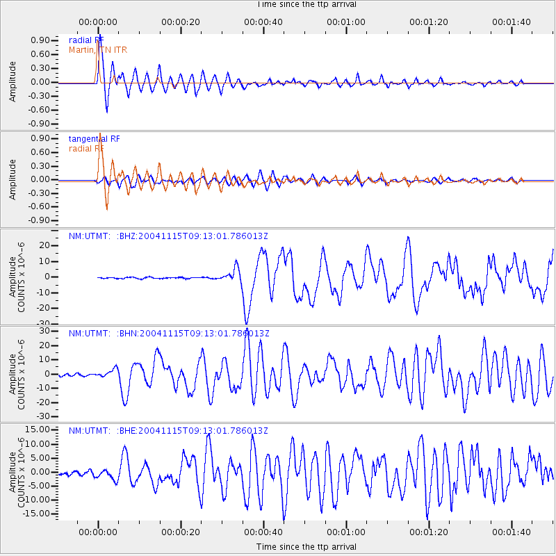
| Channel | StoN | STA | LTA |
| NM:UTMT: :BHN:20041115T09:13:01.786013Z | 3.0530949 | 2.924658E-6 | 9.579322E-7 |
| NM:UTMT: :BHE:20041115T09:13:01.786013Z | 2.7562592 | 1.7994817E-6 | 6.5287094E-7 |
| NM:UTMT: :BHZ:20041115T09:13:01.786013Z | 11.539912 | 4.4419317E-6 | 3.8491902E-7 |
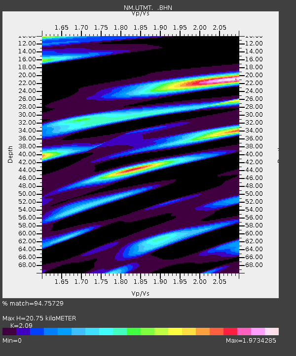
| Arrivals | |
| Ps | 3.8 SECOND |
| PpPs | 9.3 SECOND |
| PsPs/PpSs | 13 SECOND |

