
UTMT Martin, TN - Earthquake Result Viewer
| ||||||||||||||||||
| ||||||||||||||||||
| ||||||||||||||||||
|
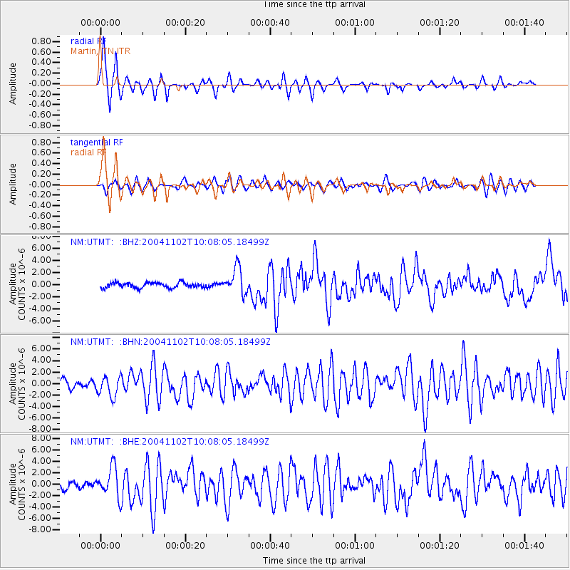
Signal To Noise
| Channel | StoN | STA | LTA |
| NM:UTMT: :BHN:20041102T10:08:05.18499Z | 2.964915 | 1.7578977E-6 | 5.928999E-7 |
| NM:UTMT: :BHE:20041102T10:08:05.18499Z | 3.963409 | 2.6985992E-6 | 6.808783E-7 |
| NM:UTMT: :BHZ:20041102T10:08:05.18499Z | 5.348035 | 2.2389177E-6 | 4.1864305E-7 |
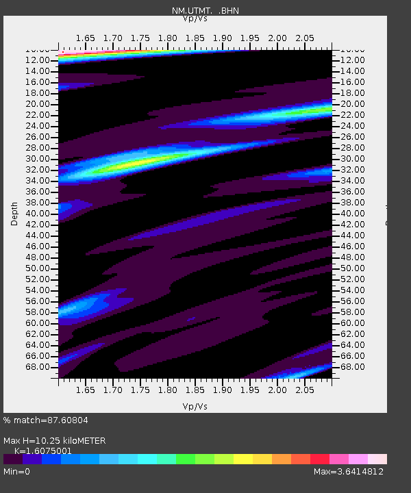
| Arrivals | |
| Ps | 1.1 SECOND |
| PpPs | 3.8 SECOND |
| PsPs/PpSs | 4.9 SECOND |

