You are here: Home > Network List > NM - Cooperative New Madrid Seismic Network Stations List
> Station UTMT Martin, TN > Earthquake Result Viewer
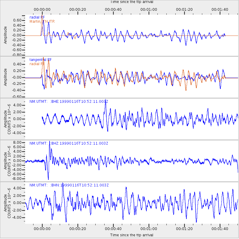
UTMT Martin, TN - Earthquake Result Viewer
*The percent match for this event was below the threshold and hence no stack was calculated.
| Earthquake location: |
Gulf Of Alaska |
| Earthquake latitude/longitude: |
56.2/-147.4 |
| Earthquake time(UTC): |
1999/01/16 (016) 10:44:39 GMT |
| Earthquake Depth: |
21 km |
| Earthquake Magnitude: |
5.9 MB, 5.7 MS, 6.0 MW, 6.0 ME |
| Earthquake Catalog/Contributor: |
WHDF/NEIC |
|
| Network: |
NM Cooperative New Madrid Seismic Network |
| Station: |
UTMT Martin, TN |
| Lat/Lon: |
36.34 N/88.86 W |
| Elevation: |
120 m |
|
| Distance: |
43.6 deg |
| Az: |
91.652 deg |
| Baz: |
316.265 deg |
| Ray Param: |
$rayparam |
*The percent match for this event was below the threshold and hence was not used in the summary stack. |
|
| Radial Match: |
60.093597 % |
| Radial Bump: |
391 |
| Transverse Match: |
47.408157 % |
| Transverse Bump: |
400 |
| SOD ConfigId: |
4480 |
| Insert Time: |
2010-03-09 11:43:27.221 +0000 |
| GWidth: |
2.5 |
| Max Bumps: |
400 |
| Tol: |
0.001 |
|
Signal To Noise
| Channel | StoN | STA | LTA |
| NM:UTMT: :BHZ:19990116T10:52:11.003Z | 8.490557 | 3.313082E-6 | 3.9020784E-7 |
| NM:UTMT: :BHN:19990116T10:52:11.003Z | 0.78640175 | 1.197708E-6 | 1.523023E-6 |
| NM:UTMT: :BHE:19990116T10:52:11.003Z | 1.4775764 | 1.2631998E-6 | 8.5491337E-7 |
| Arrivals |
| Ps | |
| PpPs | |
| PsPs/PpSs | |


