You are here: Home > Network List > US - United States National Seismic Network Stations List
> Station GLMI Grayling, Michigan, USA > Earthquake Result Viewer
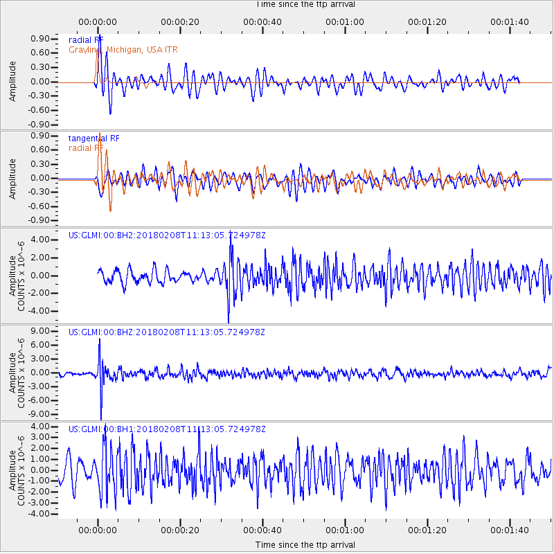
GLMI Grayling, Michigan, USA - Earthquake Result Viewer
*The percent match for this event was below the threshold and hence no stack was calculated.
| Earthquake location: |
Andreanof Islands, Aleutian Is. |
| Earthquake latitude/longitude: |
52.6/-179.5 |
| Earthquake time(UTC): |
2018/02/08 (039) 11:04:01 GMT |
| Earthquake Depth: |
211 km |
| Earthquake Magnitude: |
5.6 Mww |
| Earthquake Catalog/Contributor: |
NEIC PDE/us |
|
| Network: |
US United States National Seismic Network |
| Station: |
GLMI Grayling, Michigan, USA |
| Lat/Lon: |
44.82 N/84.62 W |
| Elevation: |
387 m |
|
| Distance: |
58.7 deg |
| Az: |
56.108 deg |
| Baz: |
314.601 deg |
| Ray Param: |
$rayparam |
*The percent match for this event was below the threshold and hence was not used in the summary stack. |
|
| Radial Match: |
76.37985 % |
| Radial Bump: |
400 |
| Transverse Match: |
67.977234 % |
| Transverse Bump: |
400 |
| SOD ConfigId: |
2546091 |
| Insert Time: |
2018-02-22 11:11:47.210 +0000 |
| GWidth: |
2.5 |
| Max Bumps: |
400 |
| Tol: |
0.001 |
|
Signal To Noise
| Channel | StoN | STA | LTA |
| US:GLMI:00:BHZ:20180208T11:13:05.724978Z | 5.9052987 | 2.7753306E-6 | 4.6997292E-7 |
| US:GLMI:00:BH1:20180208T11:13:05.724978Z | 2.3227673 | 2.0220004E-6 | 8.7051353E-7 |
| US:GLMI:00:BH2:20180208T11:13:05.724978Z | 3.1152687 | 2.0593666E-6 | 6.610559E-7 |
| Arrivals |
| Ps | |
| PpPs | |
| PsPs/PpSs | |


