You are here: Home > Network List > US - United States National Seismic Network Stations List
> Station HAWA Hanford, Washington, USA > Earthquake Result Viewer
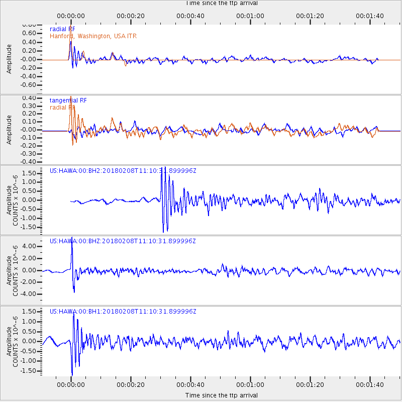
HAWA Hanford, Washington, USA - Earthquake Result Viewer
*The percent match for this event was below the threshold and hence no stack was calculated.
| Earthquake location: |
Andreanof Islands, Aleutian Is. |
| Earthquake latitude/longitude: |
52.6/-179.5 |
| Earthquake time(UTC): |
2018/02/08 (039) 11:04:01 GMT |
| Earthquake Depth: |
211 km |
| Earthquake Magnitude: |
5.6 Mww |
| Earthquake Catalog/Contributor: |
NEIC PDE/us |
|
| Network: |
US United States National Seismic Network |
| Station: |
HAWA Hanford, Washington, USA |
| Lat/Lon: |
46.39 N/119.53 W |
| Elevation: |
364 m |
|
| Distance: |
38.4 deg |
| Az: |
74.528 deg |
| Baz: |
301.794 deg |
| Ray Param: |
$rayparam |
*The percent match for this event was below the threshold and hence was not used in the summary stack. |
|
| Radial Match: |
64.97558 % |
| Radial Bump: |
400 |
| Transverse Match: |
59.77108 % |
| Transverse Bump: |
400 |
| SOD ConfigId: |
2546091 |
| Insert Time: |
2018-02-22 11:11:50.226 +0000 |
| GWidth: |
2.5 |
| Max Bumps: |
400 |
| Tol: |
0.001 |
|
Signal To Noise
| Channel | StoN | STA | LTA |
| US:HAWA:00:BHZ:20180208T11:10:31.899996Z | 12.846323 | 1.6420469E-6 | 1.2782232E-7 |
| US:HAWA:00:BH1:20180208T11:10:31.899996Z | 7.544917 | 7.4813397E-7 | 9.915735E-8 |
| US:HAWA:00:BH2:20180208T11:10:31.899996Z | 12.55049 | 9.724089E-7 | 7.747975E-8 |
| Arrivals |
| Ps | |
| PpPs | |
| PsPs/PpSs | |


