You are here: Home > Network List > G - GEOSCOPE Stations List
> Station MPG Montagne des Peres, French Guyana > Earthquake Result Viewer
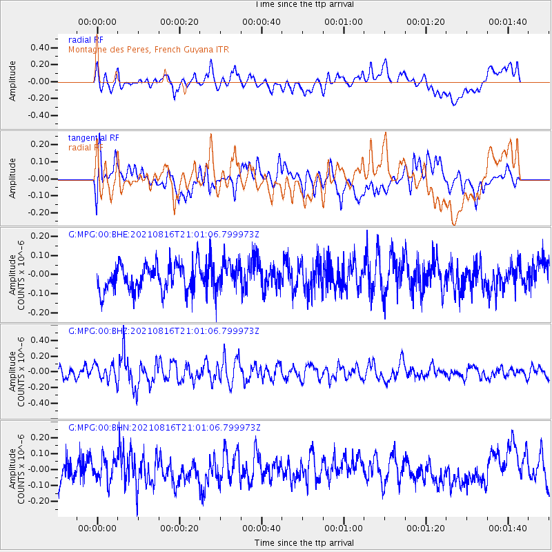
MPG Montagne des Peres, French Guyana - Earthquake Result Viewer
*The percent match for this event was below the threshold and hence no stack was calculated.
| Earthquake location: |
South Sandwich Islands Region |
| Earthquake latitude/longitude: |
-60.3/-24.9 |
| Earthquake time(UTC): |
2021/08/16 (228) 20:50:34 GMT |
| Earthquake Depth: |
10 km |
| Earthquake Magnitude: |
5.5 mww |
| Earthquake Catalog/Contributor: |
NEIC PDE/us |
|
| Network: |
G GEOSCOPE |
| Station: |
MPG Montagne des Peres, French Guyana |
| Lat/Lon: |
5.11 N/52.64 W |
| Elevation: |
147 m |
|
| Distance: |
68.7 deg |
| Az: |
330.161 deg |
| Baz: |
165.575 deg |
| Ray Param: |
$rayparam |
*The percent match for this event was below the threshold and hence was not used in the summary stack. |
|
| Radial Match: |
62.315918 % |
| Radial Bump: |
400 |
| Transverse Match: |
53.052505 % |
| Transverse Bump: |
400 |
| SOD ConfigId: |
25131211 |
| Insert Time: |
2021-08-30 20:52:48.176 +0000 |
| GWidth: |
2.5 |
| Max Bumps: |
400 |
| Tol: |
0.001 |
|
Signal To Noise
| Channel | StoN | STA | LTA |
| G:MPG:00:BHZ:20210816T21:01:06.799973Z | 1.5701482 | 1.0596841E-7 | 6.748943E-8 |
| G:MPG:00:BHN:20210816T21:01:06.799973Z | 0.85895044 | 7.064741E-8 | 8.224853E-8 |
| G:MPG:00:BHE:20210816T21:01:06.799973Z | 1.049506 | 7.458325E-8 | 7.10651E-8 |
| Arrivals |
| Ps | |
| PpPs | |
| PsPs/PpSs | |


