You are here: Home > Network List > AK - Alaska Regional Network Stations List
> Station MDM Murphy Dome > Earthquake Result Viewer
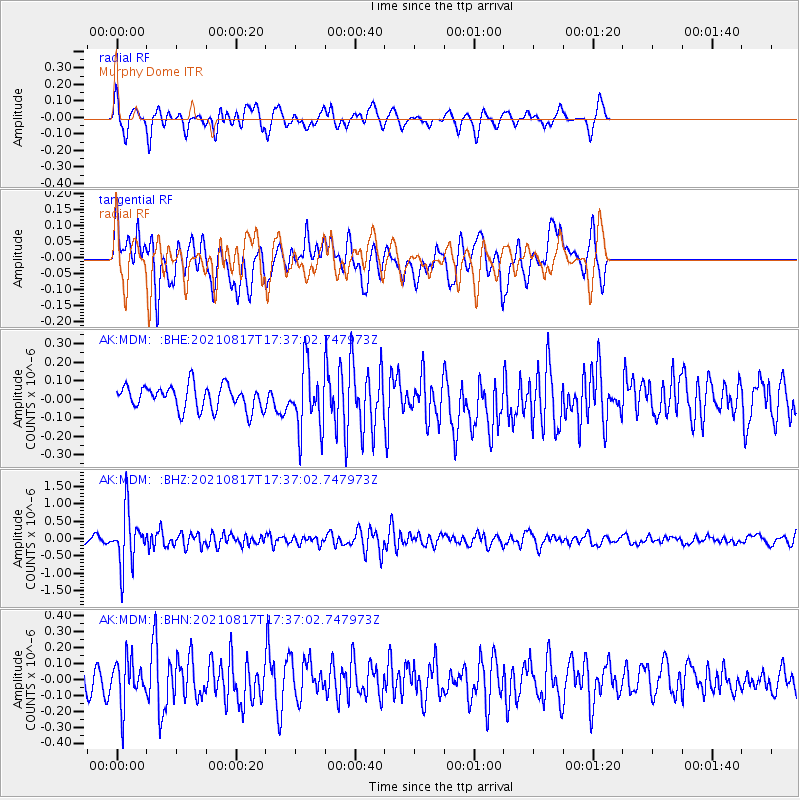
MDM Murphy Dome - Earthquake Result Viewer
*The percent match for this event was below the threshold and hence no stack was calculated.
| Earthquake location: |
South Of Fiji Islands |
| Earthquake latitude/longitude: |
-23.2/-177.0 |
| Earthquake time(UTC): |
2021/08/17 (229) 17:24:47 GMT |
| Earthquake Depth: |
139 km |
| Earthquake Magnitude: |
5.8 Mww |
| Earthquake Catalog/Contributor: |
NEIC PDE/us |
|
| Network: |
AK Alaska Regional Network |
| Station: |
MDM Murphy Dome |
| Lat/Lon: |
64.96 N/148.23 W |
| Elevation: |
634 m |
|
| Distance: |
90.7 deg |
| Az: |
11.805 deg |
| Baz: |
206.244 deg |
| Ray Param: |
$rayparam |
*The percent match for this event was below the threshold and hence was not used in the summary stack. |
|
| Radial Match: |
67.29193 % |
| Radial Bump: |
348 |
| Transverse Match: |
60.560635 % |
| Transverse Bump: |
400 |
| SOD ConfigId: |
25131211 |
| Insert Time: |
2021-08-31 17:28:06.734 +0000 |
| GWidth: |
2.5 |
| Max Bumps: |
400 |
| Tol: |
0.001 |
|
Signal To Noise
| Channel | StoN | STA | LTA |
| AK:MDM: :BHZ:20210817T17:37:02.747973Z | 10.5016365 | 7.662308E-7 | 7.296299E-8 |
| AK:MDM: :BHN:20210817T17:37:02.747973Z | 1.7116805 | 1.4120639E-7 | 8.249575E-8 |
| AK:MDM: :BHE:20210817T17:37:02.747973Z | 2.6344864 | 1.7096546E-7 | 6.4895175E-8 |
| Arrivals |
| Ps | |
| PpPs | |
| PsPs/PpSs | |


