You are here: Home > Network List > IU - Global Seismograph Network (GSN - IRIS/USGS) Stations List
> Station PMG Port Moresby, New Guinea > Earthquake Result Viewer
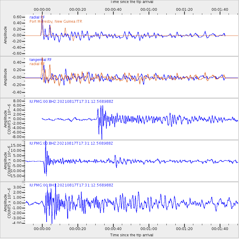
PMG Port Moresby, New Guinea - Earthquake Result Viewer
*The percent match for this event was below the threshold and hence no stack was calculated.
| Earthquake location: |
South Of Fiji Islands |
| Earthquake latitude/longitude: |
-23.2/-177.0 |
| Earthquake time(UTC): |
2021/08/17 (229) 17:24:47 GMT |
| Earthquake Depth: |
139 km |
| Earthquake Magnitude: |
5.8 Mww |
| Earthquake Catalog/Contributor: |
NEIC PDE/us |
|
| Network: |
IU Global Seismograph Network (GSN - IRIS/USGS) |
| Station: |
PMG Port Moresby, New Guinea |
| Lat/Lon: |
9.40 S/147.16 E |
| Elevation: |
90 m |
|
| Distance: |
37.0 deg |
| Az: |
285.834 deg |
| Baz: |
116.238 deg |
| Ray Param: |
$rayparam |
*The percent match for this event was below the threshold and hence was not used in the summary stack. |
|
| Radial Match: |
82.55636 % |
| Radial Bump: |
400 |
| Transverse Match: |
81.535736 % |
| Transverse Bump: |
400 |
| SOD ConfigId: |
25131211 |
| Insert Time: |
2021-08-31 17:39:03.253 +0000 |
| GWidth: |
2.5 |
| Max Bumps: |
400 |
| Tol: |
0.001 |
|
Signal To Noise
| Channel | StoN | STA | LTA |
| IU:PMG:00:BHZ:20210817T17:31:12.568988Z | 28.8903 | 6.2767954E-6 | 2.1726306E-7 |
| IU:PMG:00:BH1:20210817T17:31:12.568988Z | 6.2346206 | 1.3532427E-6 | 2.1705296E-7 |
| IU:PMG:00:BH2:20210817T17:31:12.568988Z | 11.069158 | 3.2442715E-6 | 2.930911E-7 |
| Arrivals |
| Ps | |
| PpPs | |
| PsPs/PpSs | |


