You are here: Home > Network List > UW - Pacific Northwest Regional Seismic Network Stations List
> Station IRON Crane, OR, USA > Earthquake Result Viewer
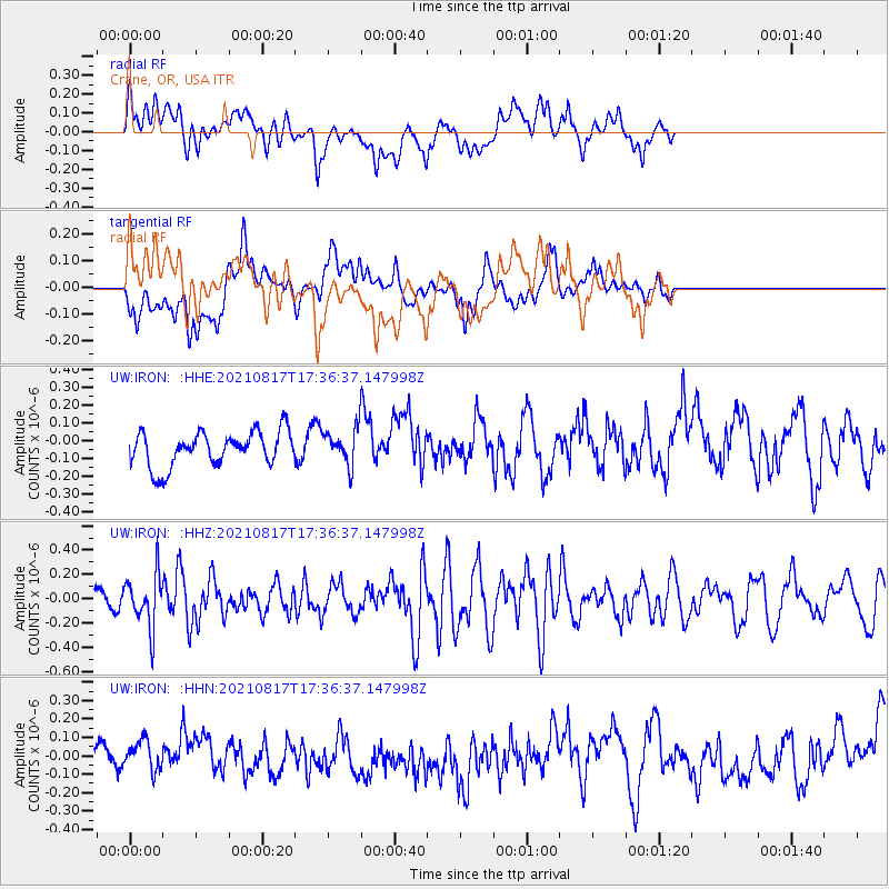
IRON Crane, OR, USA - Earthquake Result Viewer
*The percent match for this event was below the threshold and hence no stack was calculated.
| Earthquake location: |
South Of Fiji Islands |
| Earthquake latitude/longitude: |
-23.2/-177.0 |
| Earthquake time(UTC): |
2021/08/17 (229) 17:24:47 GMT |
| Earthquake Depth: |
139 km |
| Earthquake Magnitude: |
5.8 Mww |
| Earthquake Catalog/Contributor: |
NEIC PDE/us |
|
| Network: |
UW Pacific Northwest Regional Seismic Network |
| Station: |
IRON Crane, OR, USA |
| Lat/Lon: |
43.36 N/118.47 W |
| Elevation: |
1226 m |
|
| Distance: |
85.3 deg |
| Az: |
38.602 deg |
| Baz: |
231.901 deg |
| Ray Param: |
$rayparam |
*The percent match for this event was below the threshold and hence was not used in the summary stack. |
|
| Radial Match: |
62.08571 % |
| Radial Bump: |
400 |
| Transverse Match: |
44.41862 % |
| Transverse Bump: |
400 |
| SOD ConfigId: |
25131211 |
| Insert Time: |
2021-08-31 17:47:37.684 +0000 |
| GWidth: |
2.5 |
| Max Bumps: |
400 |
| Tol: |
0.001 |
|
Signal To Noise
| Channel | StoN | STA | LTA |
| UW:IRON: :HHZ:20210817T17:36:37.147998Z | 2.301722 | 2.1224994E-7 | 9.221355E-8 |
| UW:IRON: :HHN:20210817T17:36:37.147998Z | 0.9193976 | 8.337311E-8 | 9.068232E-8 |
| UW:IRON: :HHE:20210817T17:36:37.147998Z | 1.0023329 | 9.7559585E-8 | 9.733252E-8 |
| Arrivals |
| Ps | |
| PpPs | |
| PsPs/PpSs | |


