You are here: Home > Network List > IU - Global Seismograph Network (GSN - IRIS/USGS) Stations List
> Station JOHN Johnston Island, USA > Earthquake Result Viewer
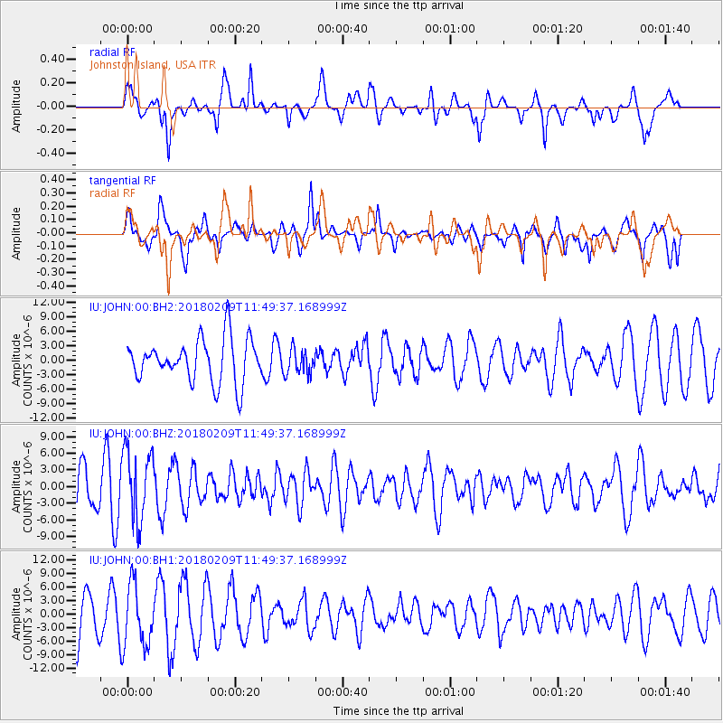
JOHN Johnston Island, USA - Earthquake Result Viewer
*The percent match for this event was below the threshold and hence no stack was calculated.
| Earthquake location: |
Fiji Islands Region |
| Earthquake latitude/longitude: |
-17.9/-178.7 |
| Earthquake time(UTC): |
2018/02/09 (040) 11:43:56 GMT |
| Earthquake Depth: |
545 km |
| Earthquake Magnitude: |
5.9 Mww |
| Earthquake Catalog/Contributor: |
NEIC PDE/us |
|
| Network: |
IU Global Seismograph Network (GSN - IRIS/USGS) |
| Station: |
JOHN Johnston Island, USA |
| Lat/Lon: |
16.73 N/169.53 W |
| Elevation: |
2.0 m |
|
| Distance: |
35.6 deg |
| Az: |
15.164 deg |
| Baz: |
195.068 deg |
| Ray Param: |
$rayparam |
*The percent match for this event was below the threshold and hence was not used in the summary stack. |
|
| Radial Match: |
63.3794 % |
| Radial Bump: |
400 |
| Transverse Match: |
76.003845 % |
| Transverse Bump: |
400 |
| SOD ConfigId: |
2546091 |
| Insert Time: |
2018-02-23 11:48:01.730 +0000 |
| GWidth: |
2.5 |
| Max Bumps: |
400 |
| Tol: |
0.001 |
|
Signal To Noise
| Channel | StoN | STA | LTA |
| IU:JOHN:00:BHZ:20180209T11:49:37.168999Z | 1.3258657 | 6.430616E-6 | 4.850126E-6 |
| IU:JOHN:00:BH1:20180209T11:49:37.168999Z | 1.5606245 | 6.906387E-6 | 4.4253998E-6 |
| IU:JOHN:00:BH2:20180209T11:49:37.168999Z | 0.5774244 | 2.580849E-6 | 4.4695876E-6 |
| Arrivals |
| Ps | |
| PpPs | |
| PsPs/PpSs | |


