You are here: Home > Network List > IU - Global Seismograph Network (GSN - IRIS/USGS) Stations List
> Station PMG Port Moresby, New Guinea > Earthquake Result Viewer
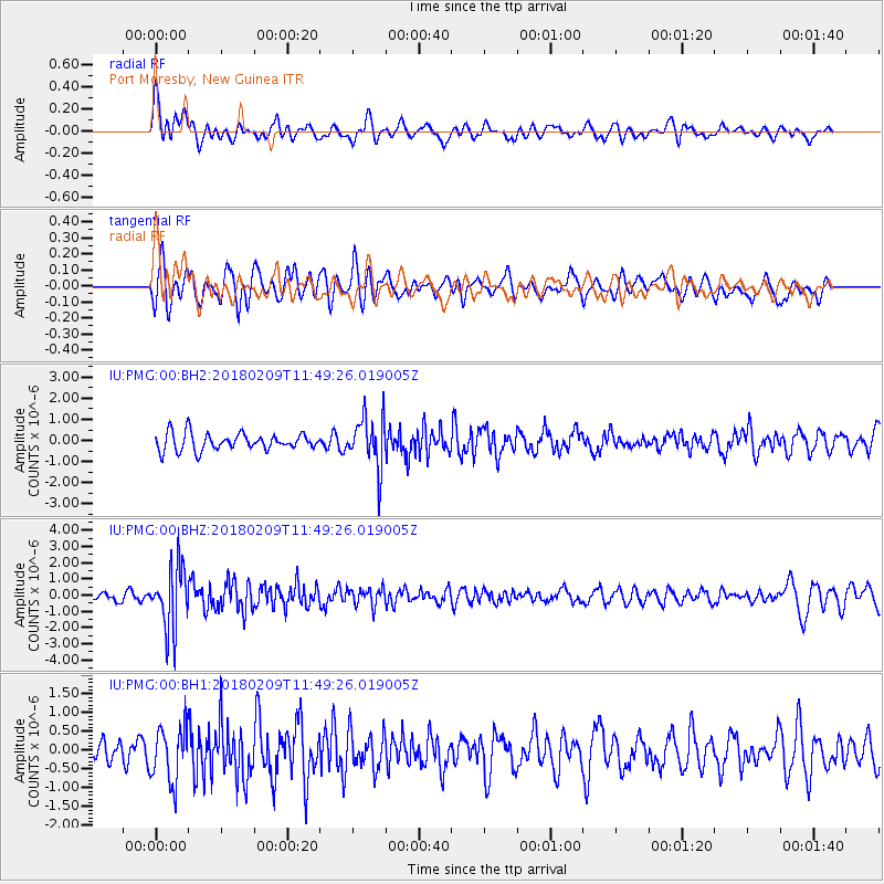
PMG Port Moresby, New Guinea - Earthquake Result Viewer
*The percent match for this event was below the threshold and hence no stack was calculated.
| Earthquake location: |
Fiji Islands Region |
| Earthquake latitude/longitude: |
-17.9/-178.7 |
| Earthquake time(UTC): |
2018/02/09 (040) 11:43:56 GMT |
| Earthquake Depth: |
545 km |
| Earthquake Magnitude: |
5.9 Mww |
| Earthquake Catalog/Contributor: |
NEIC PDE/us |
|
| Network: |
IU Global Seismograph Network (GSN - IRIS/USGS) |
| Station: |
PMG Port Moresby, New Guinea |
| Lat/Lon: |
9.40 S/147.16 E |
| Elevation: |
90 m |
|
| Distance: |
34.2 deg |
| Az: |
279.688 deg |
| Baz: |
107.955 deg |
| Ray Param: |
$rayparam |
*The percent match for this event was below the threshold and hence was not used in the summary stack. |
|
| Radial Match: |
59.224342 % |
| Radial Bump: |
400 |
| Transverse Match: |
59.463024 % |
| Transverse Bump: |
400 |
| SOD ConfigId: |
2546091 |
| Insert Time: |
2018-02-23 11:48:09.738 +0000 |
| GWidth: |
2.5 |
| Max Bumps: |
400 |
| Tol: |
0.001 |
|
Signal To Noise
| Channel | StoN | STA | LTA |
| IU:PMG:00:BHZ:20180209T11:49:26.019005Z | 4.458534 | 1.977631E-6 | 4.4356085E-7 |
| IU:PMG:00:BH1:20180209T11:49:26.019005Z | 2.316066 | 7.359967E-7 | 3.1777878E-7 |
| IU:PMG:00:BH2:20180209T11:49:26.019005Z | 2.9138749 | 1.1814765E-6 | 4.0546576E-7 |
| Arrivals |
| Ps | |
| PpPs | |
| PsPs/PpSs | |


