You are here: Home > Network List > G - GEOSCOPE Stations List
> Station TAM Tamanrasset, Algeria > Earthquake Result Viewer
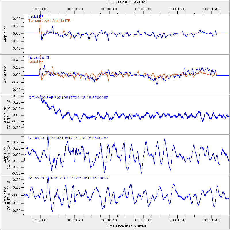
TAM Tamanrasset, Algeria - Earthquake Result Viewer
*The percent match for this event was below the threshold and hence no stack was calculated.
| Earthquake location: |
South Sandwich Islands Region |
| Earthquake latitude/longitude: |
-59.6/-26.1 |
| Earthquake time(UTC): |
2021/08/17 (229) 20:06:13 GMT |
| Earthquake Depth: |
40 km |
| Earthquake Magnitude: |
5.6 mww |
| Earthquake Catalog/Contributor: |
NEIC PDE/us |
|
| Network: |
G GEOSCOPE |
| Station: |
TAM Tamanrasset, Algeria |
| Lat/Lon: |
22.79 N/5.53 E |
| Elevation: |
1377 m |
|
| Distance: |
86.1 deg |
| Az: |
28.977 deg |
| Baz: |
195.464 deg |
| Ray Param: |
$rayparam |
*The percent match for this event was below the threshold and hence was not used in the summary stack. |
|
| Radial Match: |
57.28923 % |
| Radial Bump: |
400 |
| Transverse Match: |
30.282972 % |
| Transverse Bump: |
400 |
| SOD ConfigId: |
25131211 |
| Insert Time: |
2021-08-31 20:08:34.147 +0000 |
| GWidth: |
2.5 |
| Max Bumps: |
400 |
| Tol: |
0.001 |
|
Signal To Noise
| Channel | StoN | STA | LTA |
| G:TAM:00:BHZ:20210817T20:18:18.850008Z | 1.3306594 | 1.1148794E-7 | 8.378399E-8 |
| G:TAM:00:BHN:20210817T20:18:18.850008Z | 2.4083164 | 9.5663815E-8 | 3.972228E-8 |
| G:TAM:00:BHE:20210817T20:18:18.850008Z | 0.79445785 | 7.5638056E-8 | 9.5207135E-8 |
| Arrivals |
| Ps | |
| PpPs | |
| PsPs/PpSs | |


