You are here: Home > Network List > TA - USArray Transportable Network (new EarthScope stations) Stations List
> Station TUL3 Leonard, OK, USA > Earthquake Result Viewer
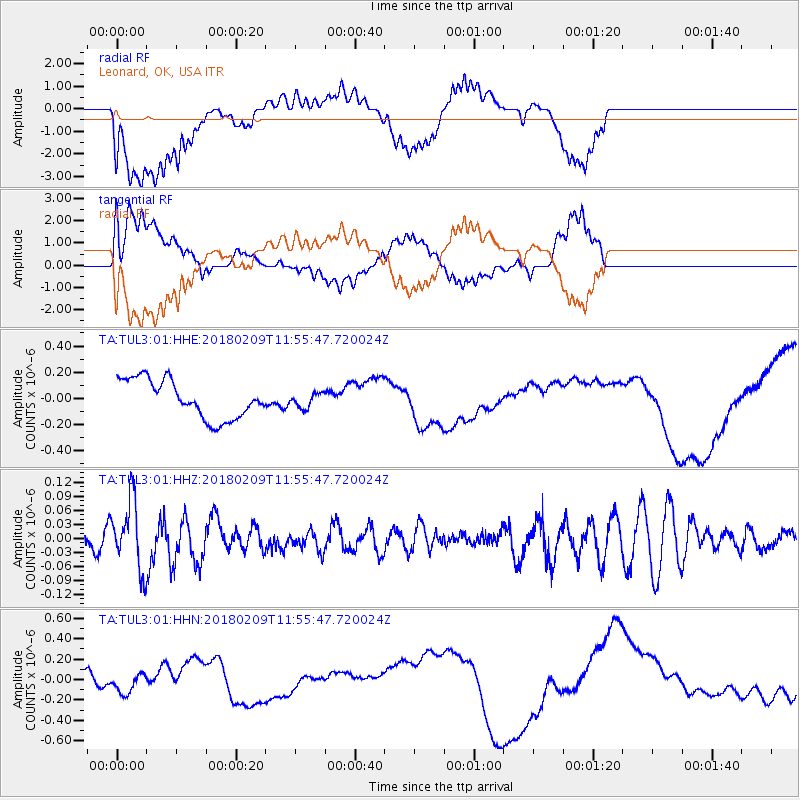
TUL3 Leonard, OK, USA - Earthquake Result Viewer
*The percent match for this event was below the threshold and hence no stack was calculated.
| Earthquake location: |
Fiji Islands Region |
| Earthquake latitude/longitude: |
-17.9/-178.7 |
| Earthquake time(UTC): |
2018/02/09 (040) 11:43:56 GMT |
| Earthquake Depth: |
545 km |
| Earthquake Magnitude: |
5.9 Mww |
| Earthquake Catalog/Contributor: |
NEIC PDE/us |
|
| Network: |
TA USArray Transportable Network (new EarthScope stations) |
| Station: |
TUL3 Leonard, OK, USA |
| Lat/Lon: |
35.91 N/95.79 W |
| Elevation: |
265 m |
|
| Distance: |
94.7 deg |
| Az: |
53.927 deg |
| Baz: |
251.464 deg |
| Ray Param: |
$rayparam |
*The percent match for this event was below the threshold and hence was not used in the summary stack. |
|
| Radial Match: |
41.95095 % |
| Radial Bump: |
400 |
| Transverse Match: |
54.155415 % |
| Transverse Bump: |
400 |
| SOD ConfigId: |
2546091 |
| Insert Time: |
2018-02-23 11:48:53.956 +0000 |
| GWidth: |
2.5 |
| Max Bumps: |
400 |
| Tol: |
0.001 |
|
Signal To Noise
| Channel | StoN | STA | LTA |
| TA:TUL3:01:HHZ:20180209T11:55:47.720024Z | 1.6382561 | 7.156589E-8 | 4.368419E-8 |
| TA:TUL3:01:HHN:20180209T11:55:47.720024Z | 0.49428418 | 1.1434223E-7 | 2.3132893E-7 |
| TA:TUL3:01:HHE:20180209T11:55:47.720024Z | 0.3792141 | 5.5322946E-8 | 1.4588841E-7 |
| Arrivals |
| Ps | |
| PpPs | |
| PsPs/PpSs | |


