You are here: Home > Network List > US - United States National Seismic Network Stations List
> Station AMTX Amarillo, Texas, USA > Earthquake Result Viewer
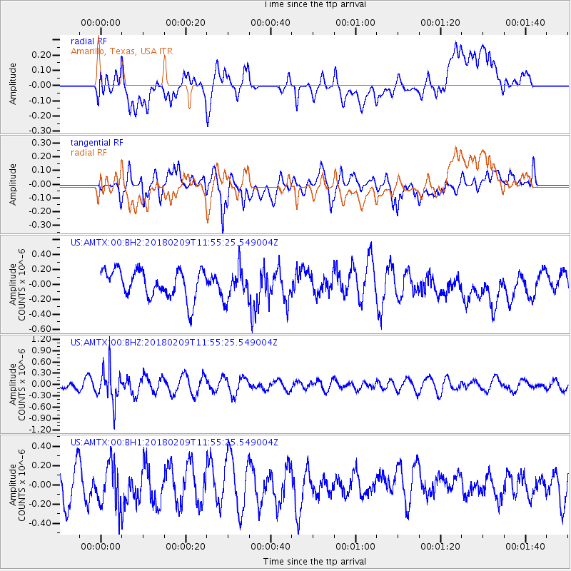
AMTX Amarillo, Texas, USA - Earthquake Result Viewer
*The percent match for this event was below the threshold and hence no stack was calculated.
| Earthquake location: |
Fiji Islands Region |
| Earthquake latitude/longitude: |
-17.9/-178.7 |
| Earthquake time(UTC): |
2018/02/09 (040) 11:43:56 GMT |
| Earthquake Depth: |
545 km |
| Earthquake Magnitude: |
5.9 Mww |
| Earthquake Catalog/Contributor: |
NEIC PDE/us |
|
| Network: |
US United States National Seismic Network |
| Station: |
AMTX Amarillo, Texas, USA |
| Lat/Lon: |
34.53 N/101.41 W |
| Elevation: |
1010 m |
|
| Distance: |
89.9 deg |
| Az: |
53.635 deg |
| Baz: |
248.249 deg |
| Ray Param: |
$rayparam |
*The percent match for this event was below the threshold and hence was not used in the summary stack. |
|
| Radial Match: |
45.257504 % |
| Radial Bump: |
400 |
| Transverse Match: |
47.965492 % |
| Transverse Bump: |
400 |
| SOD ConfigId: |
2546091 |
| Insert Time: |
2018-02-23 11:50:01.730 +0000 |
| GWidth: |
2.5 |
| Max Bumps: |
400 |
| Tol: |
0.001 |
|
Signal To Noise
| Channel | StoN | STA | LTA |
| US:AMTX:00:BHZ:20180209T11:55:25.549004Z | 2.665226 | 4.3647896E-7 | 1.6376808E-7 |
| US:AMTX:00:BH1:20180209T11:55:25.549004Z | 1.1719884 | 2.2296052E-7 | 1.9024124E-7 |
| US:AMTX:00:BH2:20180209T11:55:25.549004Z | 1.0689676 | 1.9913321E-7 | 1.8628555E-7 |
| Arrivals |
| Ps | |
| PpPs | |
| PsPs/PpSs | |


