You are here: Home > Network List > US - United States National Seismic Network Stations List
> Station DGMT Dagmar, Montana, USA > Earthquake Result Viewer
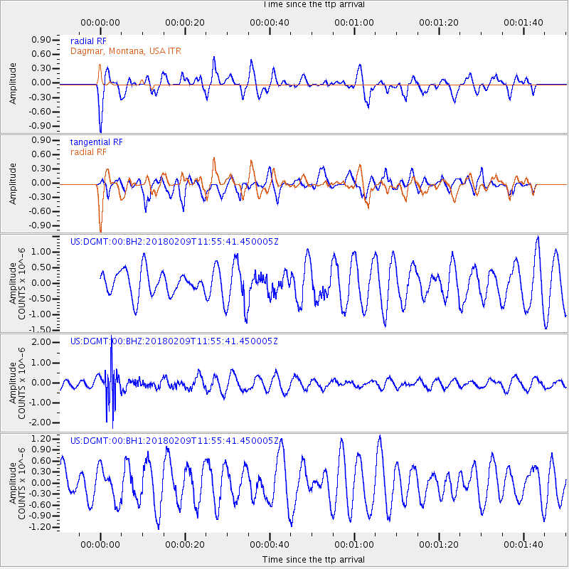
DGMT Dagmar, Montana, USA - Earthquake Result Viewer
*The percent match for this event was below the threshold and hence no stack was calculated.
| Earthquake location: |
Fiji Islands Region |
| Earthquake latitude/longitude: |
-17.9/-178.7 |
| Earthquake time(UTC): |
2018/02/09 (040) 11:43:56 GMT |
| Earthquake Depth: |
545 km |
| Earthquake Magnitude: |
5.9 Mww |
| Earthquake Catalog/Contributor: |
NEIC PDE/us |
|
| Network: |
US United States National Seismic Network |
| Station: |
DGMT Dagmar, Montana, USA |
| Lat/Lon: |
48.47 N/104.20 W |
| Elevation: |
0.0 m |
|
| Distance: |
93.3 deg |
| Az: |
39.963 deg |
| Baz: |
246.787 deg |
| Ray Param: |
$rayparam |
*The percent match for this event was below the threshold and hence was not used in the summary stack. |
|
| Radial Match: |
48.775948 % |
| Radial Bump: |
400 |
| Transverse Match: |
56.10837 % |
| Transverse Bump: |
389 |
| SOD ConfigId: |
2546091 |
| Insert Time: |
2018-02-23 11:50:08.521 +0000 |
| GWidth: |
2.5 |
| Max Bumps: |
400 |
| Tol: |
0.001 |
|
Signal To Noise
| Channel | StoN | STA | LTA |
| US:DGMT:00:BHZ:20180209T11:55:41.450005Z | 4.443178 | 8.233594E-7 | 1.8530866E-7 |
| US:DGMT:00:BH1:20180209T11:55:41.450005Z | 1.0110921 | 4.4701278E-7 | 4.421089E-7 |
| US:DGMT:00:BH2:20180209T11:55:41.450005Z | 1.9629052 | 7.323575E-7 | 3.7309874E-7 |
| Arrivals |
| Ps | |
| PpPs | |
| PsPs/PpSs | |


