You are here: Home > Network List > US - United States National Seismic Network Stations List
> Station EGMT Eagleton, Montana, USA > Earthquake Result Viewer
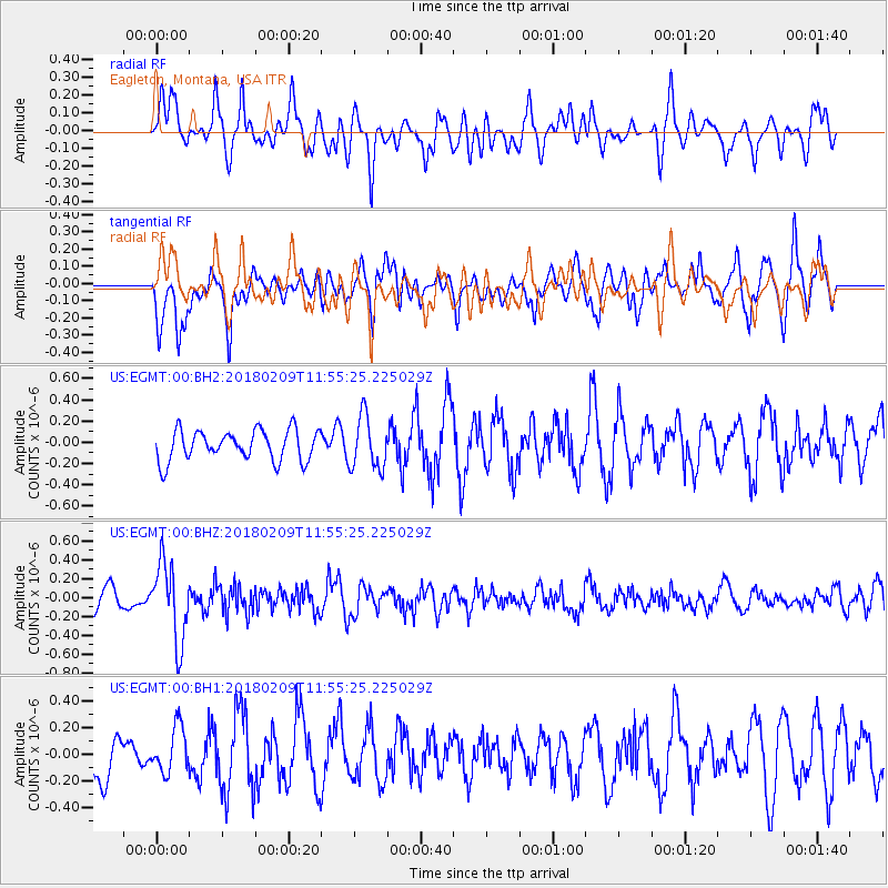
EGMT Eagleton, Montana, USA - Earthquake Result Viewer
*The percent match for this event was below the threshold and hence no stack was calculated.
| Earthquake location: |
Fiji Islands Region |
| Earthquake latitude/longitude: |
-17.9/-178.7 |
| Earthquake time(UTC): |
2018/02/09 (040) 11:43:56 GMT |
| Earthquake Depth: |
545 km |
| Earthquake Magnitude: |
5.9 Mww |
| Earthquake Catalog/Contributor: |
NEIC PDE/us |
|
| Network: |
US United States National Seismic Network |
| Station: |
EGMT Eagleton, Montana, USA |
| Lat/Lon: |
48.02 N/109.75 W |
| Elevation: |
1055 m |
|
| Distance: |
89.8 deg |
| Az: |
38.78 deg |
| Baz: |
242.683 deg |
| Ray Param: |
$rayparam |
*The percent match for this event was below the threshold and hence was not used in the summary stack. |
|
| Radial Match: |
63.561565 % |
| Radial Bump: |
400 |
| Transverse Match: |
59.887337 % |
| Transverse Bump: |
400 |
| SOD ConfigId: |
2546091 |
| Insert Time: |
2018-02-23 11:50:14.034 +0000 |
| GWidth: |
2.5 |
| Max Bumps: |
400 |
| Tol: |
0.001 |
|
Signal To Noise
| Channel | StoN | STA | LTA |
| US:EGMT:00:BHZ:20180209T11:55:25.225029Z | 3.0128648 | 4.0826262E-7 | 1.3550645E-7 |
| US:EGMT:00:BH1:20180209T11:55:25.225029Z | 0.9880189 | 1.6879876E-7 | 1.708457E-7 |
| US:EGMT:00:BH2:20180209T11:55:25.225029Z | 1.7184546 | 2.4708143E-7 | 1.4378116E-7 |
| Arrivals |
| Ps | |
| PpPs | |
| PsPs/PpSs | |


