You are here: Home > Network List > TX - Texas Seismological Network Stations List
> Station WTFS Witchita Falls > Earthquake Result Viewer
WTFS Witchita Falls - Earthquake Result Viewer
*The percent match for this event was below the threshold and hence no stack was calculated.
| Earthquake location: |
Leeward Islands |
| Earthquake latitude/longitude: |
19.0/-61.7 |
| Earthquake time(UTC): |
2018/02/09 (040) 17:43:34 GMT |
| Earthquake Depth: |
9.9 km |
| Earthquake Magnitude: |
5.5 Mi |
| Earthquake Catalog/Contributor: |
NEIC PDE/pt |
|
| Network: |
TX Texas Seismological Network |
| Station: |
WTFS Witchita Falls |
| Lat/Lon: |
33.77 N/98.46 W |
| Elevation: |
277 m |
|
| Distance: |
35.8 deg |
| Az: |
301.724 deg |
| Baz: |
104.905 deg |
| Ray Param: |
$rayparam |
*The percent match for this event was below the threshold and hence was not used in the summary stack. |
|
| Radial Match: |
47.198334 % |
| Radial Bump: |
400 |
| Transverse Match: |
49.900177 % |
| Transverse Bump: |
400 |
| SOD ConfigId: |
2546091 |
| Insert Time: |
2018-02-23 17:46:27.917 +0000 |
| GWidth: |
2.5 |
| Max Bumps: |
400 |
| Tol: |
0.001 |
|
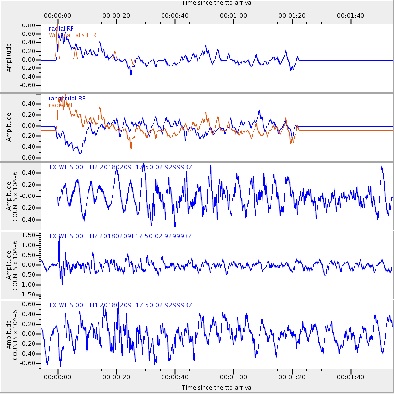
Signal To Noise
| Channel | StoN | STA | LTA |
| TX:WTFS:00:HHZ:20180209T17:50:02.929993Z | 3.4810603 | 4.41841E-7 | 1.2692713E-7 |
| TX:WTFS:00:HH1:20180209T17:50:02.929993Z | 1.3670622 | 3.169855E-7 | 2.318735E-7 |
| TX:WTFS:00:HH2:20180209T17:50:02.929993Z | 1.6583616 | 3.0394747E-7 | 1.832818E-7 |
| Arrivals |
| Ps | |
| PpPs | |
| PsPs/PpSs | |


