You are here: Home > Network List > CI - Caltech Regional Seismic Network Stations List
> Station SWS Sam W. Stewart, Westmorland, CA, USA > Earthquake Result Viewer
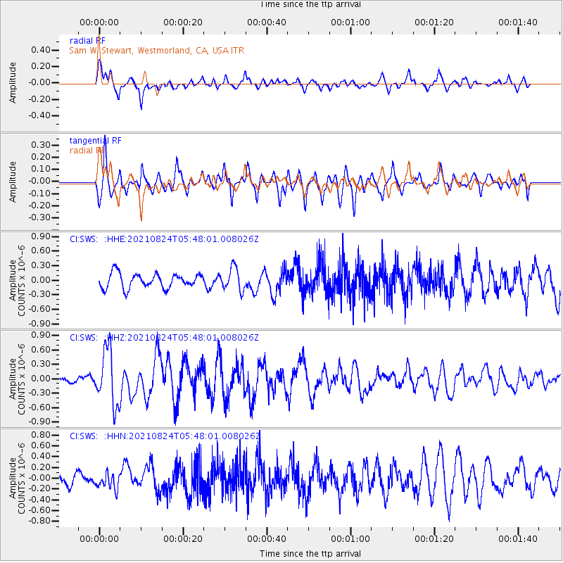
SWS Sam W. Stewart, Westmorland, CA, USA - Earthquake Result Viewer
*The percent match for this event was below the threshold and hence no stack was calculated.
| Earthquake location: |
Kuril Islands |
| Earthquake latitude/longitude: |
48.8/155.0 |
| Earthquake time(UTC): |
2021/08/24 (236) 05:37:51 GMT |
| Earthquake Depth: |
31 km |
| Earthquake Magnitude: |
6.0 mww |
| Earthquake Catalog/Contributor: |
NEIC PDE/us |
|
| Network: |
CI Caltech Regional Seismic Network |
| Station: |
SWS Sam W. Stewart, Westmorland, CA, USA |
| Lat/Lon: |
32.94 N/115.80 W |
| Elevation: |
140 m |
|
| Distance: |
65.6 deg |
| Az: |
67.432 deg |
| Baz: |
313.459 deg |
| Ray Param: |
$rayparam |
*The percent match for this event was below the threshold and hence was not used in the summary stack. |
|
| Radial Match: |
73.83567 % |
| Radial Bump: |
400 |
| Transverse Match: |
70.74135 % |
| Transverse Bump: |
400 |
| SOD ConfigId: |
25131211 |
| Insert Time: |
2021-09-07 05:48:04.892 +0000 |
| GWidth: |
2.5 |
| Max Bumps: |
400 |
| Tol: |
0.001 |
|
Signal To Noise
| Channel | StoN | STA | LTA |
| CI:SWS: :HHZ:20210824T05:48:01.008026Z | 7.8146467 | 5.834733E-7 | 7.466407E-8 |
| CI:SWS: :HHN:20210824T05:48:01.008026Z | 1.0254452 | 1.4953575E-7 | 1.458252E-7 |
| CI:SWS: :HHE:20210824T05:48:01.008026Z | 1.5980703 | 2.3861548E-7 | 1.4931477E-7 |
| Arrivals |
| Ps | |
| PpPs | |
| PsPs/PpSs | |


