You are here: Home > Network List > CI - Caltech Regional Seismic Network Stations List
> Station TIN Tinemaha, Big Pine, CA, USA > Earthquake Result Viewer
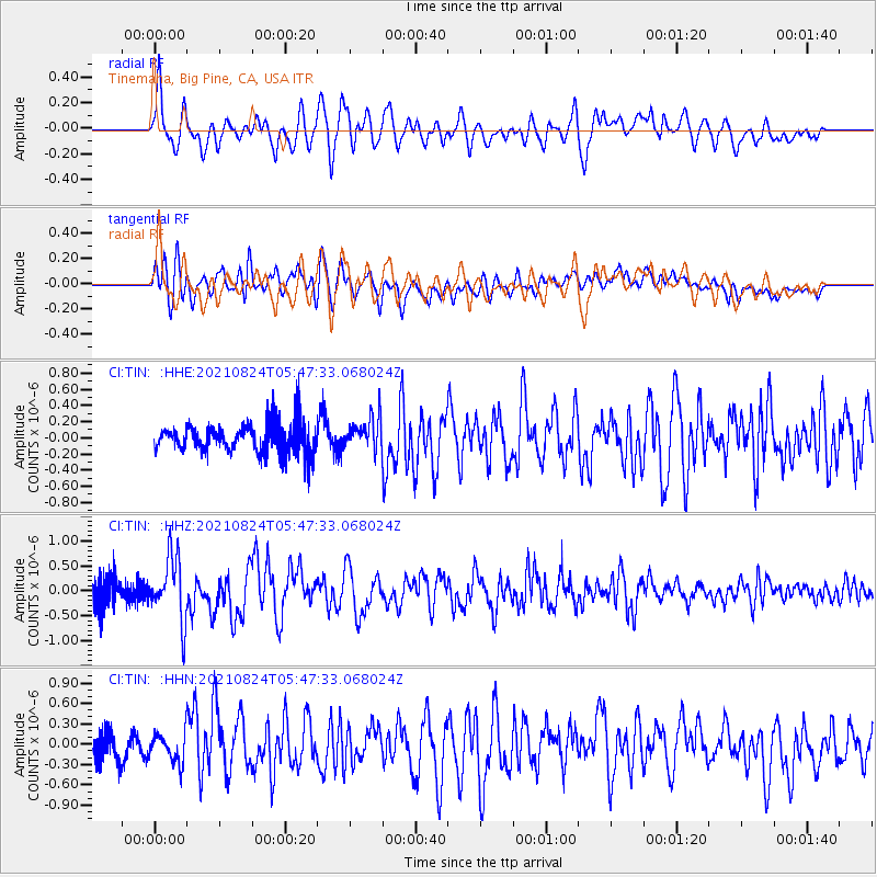
TIN Tinemaha, Big Pine, CA, USA - Earthquake Result Viewer
*The percent match for this event was below the threshold and hence no stack was calculated.
| Earthquake location: |
Kuril Islands |
| Earthquake latitude/longitude: |
48.8/155.0 |
| Earthquake time(UTC): |
2021/08/24 (236) 05:37:51 GMT |
| Earthquake Depth: |
31 km |
| Earthquake Magnitude: |
6.0 mww |
| Earthquake Catalog/Contributor: |
NEIC PDE/us |
|
| Network: |
CI Caltech Regional Seismic Network |
| Station: |
TIN Tinemaha, Big Pine, CA, USA |
| Lat/Lon: |
37.05 N/118.23 W |
| Elevation: |
1197 m |
|
| Distance: |
61.3 deg |
| Az: |
65.547 deg |
| Baz: |
311.225 deg |
| Ray Param: |
$rayparam |
*The percent match for this event was below the threshold and hence was not used in the summary stack. |
|
| Radial Match: |
74.44785 % |
| Radial Bump: |
400 |
| Transverse Match: |
77.912735 % |
| Transverse Bump: |
400 |
| SOD ConfigId: |
25131211 |
| Insert Time: |
2021-09-07 05:48:08.704 +0000 |
| GWidth: |
2.5 |
| Max Bumps: |
400 |
| Tol: |
0.001 |
|
Signal To Noise
| Channel | StoN | STA | LTA |
| CI:TIN: :HHZ:20210824T05:47:33.068024Z | 2.8293989 | 6.33951E-7 | 2.2405854E-7 |
| CI:TIN: :HHN:20210824T05:47:33.068024Z | 1.1788677 | 2.17603E-7 | 1.8458644E-7 |
| CI:TIN: :HHE:20210824T05:47:33.068024Z | 1.0754601 | 1.9877564E-7 | 1.8482847E-7 |
| Arrivals |
| Ps | |
| PpPs | |
| PsPs/PpSs | |


