You are here: Home > Network List > US - United States National Seismic Network Stations List
> Station HLID Hailey, Idaho, USA > Earthquake Result Viewer
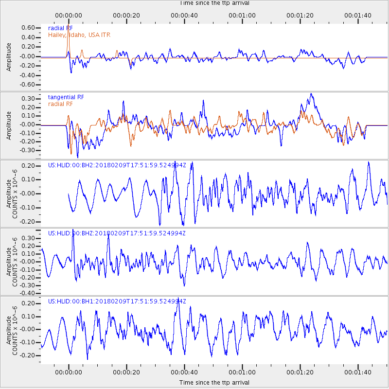
HLID Hailey, Idaho, USA - Earthquake Result Viewer
*The percent match for this event was below the threshold and hence no stack was calculated.
| Earthquake location: |
Leeward Islands |
| Earthquake latitude/longitude: |
19.0/-61.7 |
| Earthquake time(UTC): |
2018/02/09 (040) 17:43:34 GMT |
| Earthquake Depth: |
9.9 km |
| Earthquake Magnitude: |
5.5 Mi |
| Earthquake Catalog/Contributor: |
NEIC PDE/pt |
|
| Network: |
US United States National Seismic Network |
| Station: |
HLID Hailey, Idaho, USA |
| Lat/Lon: |
43.56 N/114.41 W |
| Elevation: |
1772 m |
|
| Distance: |
50.3 deg |
| Az: |
311.285 deg |
| Baz: |
101.954 deg |
| Ray Param: |
$rayparam |
*The percent match for this event was below the threshold and hence was not used in the summary stack. |
|
| Radial Match: |
41.301594 % |
| Radial Bump: |
400 |
| Transverse Match: |
49.524014 % |
| Transverse Bump: |
400 |
| SOD ConfigId: |
2546091 |
| Insert Time: |
2018-02-23 17:47:03.111 +0000 |
| GWidth: |
2.5 |
| Max Bumps: |
400 |
| Tol: |
0.001 |
|
Signal To Noise
| Channel | StoN | STA | LTA |
| US:HLID:00:BHZ:20180209T17:51:59.524994Z | 1.7415086 | 1.5103954E-7 | 8.672914E-8 |
| US:HLID:00:BH1:20180209T17:51:59.524994Z | 1.0624446 | 1.3329183E-7 | 1.2545769E-7 |
| US:HLID:00:BH2:20180209T17:51:59.524994Z | 1.2663729 | 9.389477E-8 | 7.4144644E-8 |
| Arrivals |
| Ps | |
| PpPs | |
| PsPs/PpSs | |


