You are here: Home > Network List > US - United States National Seismic Network Stations List
> Station DGMT Dagmar, Montana, USA > Earthquake Result Viewer
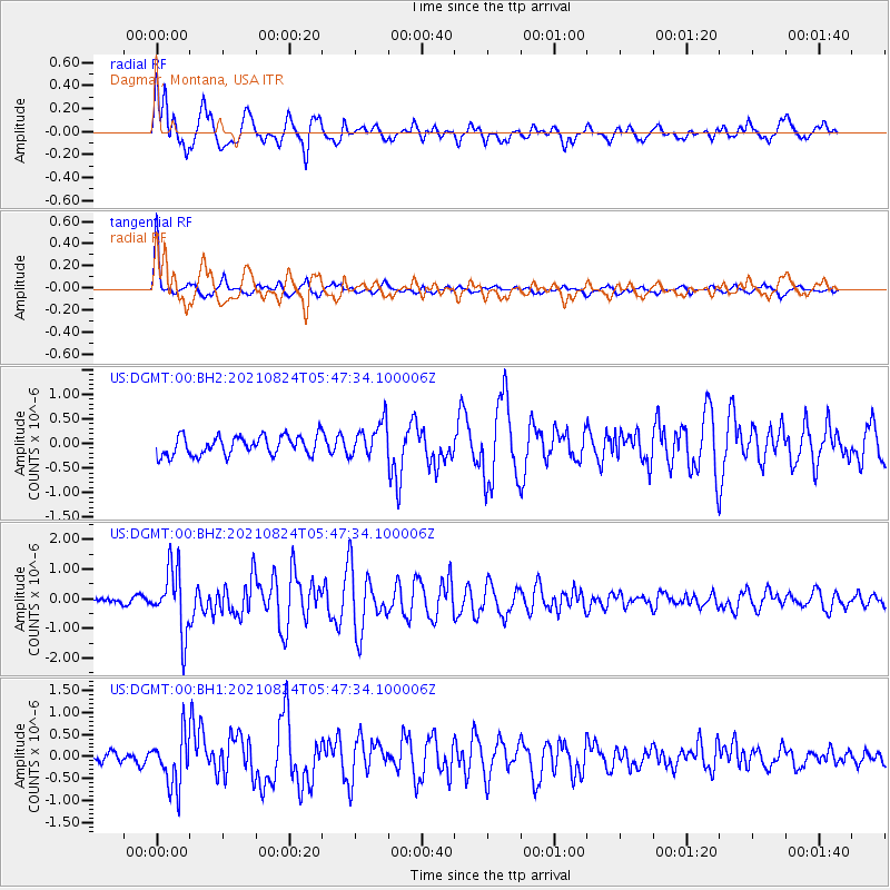
DGMT Dagmar, Montana, USA - Earthquake Result Viewer
*The percent match for this event was below the threshold and hence no stack was calculated.
| Earthquake location: |
Kuril Islands |
| Earthquake latitude/longitude: |
48.8/155.0 |
| Earthquake time(UTC): |
2021/08/24 (236) 05:37:51 GMT |
| Earthquake Depth: |
31 km |
| Earthquake Magnitude: |
6.0 mww |
| Earthquake Catalog/Contributor: |
NEIC PDE/us |
|
| Network: |
US United States National Seismic Network |
| Station: |
DGMT Dagmar, Montana, USA |
| Lat/Lon: |
48.47 N/104.20 W |
| Elevation: |
0.0 m |
|
| Distance: |
61.5 deg |
| Az: |
48.056 deg |
| Baz: |
312.374 deg |
| Ray Param: |
$rayparam |
*The percent match for this event was below the threshold and hence was not used in the summary stack. |
|
| Radial Match: |
80.32025 % |
| Radial Bump: |
400 |
| Transverse Match: |
91.03141 % |
| Transverse Bump: |
336 |
| SOD ConfigId: |
25131211 |
| Insert Time: |
2021-09-07 06:10:02.081 +0000 |
| GWidth: |
2.5 |
| Max Bumps: |
400 |
| Tol: |
0.001 |
|
Signal To Noise
| Channel | StoN | STA | LTA |
| US:DGMT:00:BHZ:20210824T05:47:34.100006Z | 7.3077807 | 1.0856925E-6 | 1.4856666E-7 |
| US:DGMT:00:BH1:20210824T05:47:34.100006Z | 3.1760187 | 5.796677E-7 | 1.8251396E-7 |
| US:DGMT:00:BH2:20210824T05:47:34.100006Z | 1.827503 | 3.5713612E-7 | 1.95423E-7 |
| Arrivals |
| Ps | |
| PpPs | |
| PsPs/PpSs | |


