You are here: Home > Network List > AV - Alaska Volcano Observatory Stations List
> Station SPCR Ckakachatna River, Mount Spurr, Alaska > Earthquake Result Viewer
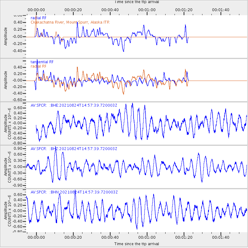
SPCR Ckakachatna River, Mount Spurr, Alaska - Earthquake Result Viewer
*The percent match for this event was below the threshold and hence no stack was calculated.
| Earthquake location: |
South Of Mariana Islands |
| Earthquake latitude/longitude: |
12.7/145.1 |
| Earthquake time(UTC): |
2021/08/24 (236) 14:47:25 GMT |
| Earthquake Depth: |
10 km |
| Earthquake Magnitude: |
5.5 Mww |
| Earthquake Catalog/Contributor: |
NEIC PDE/us |
|
| Network: |
AV Alaska Volcano Observatory |
| Station: |
SPCR Ckakachatna River, Mount Spurr, Alaska |
| Lat/Lon: |
61.20 N/152.21 W |
| Elevation: |
984 m |
|
| Distance: |
65.9 deg |
| Az: |
28.121 deg |
| Baz: |
251.759 deg |
| Ray Param: |
$rayparam |
*The percent match for this event was below the threshold and hence was not used in the summary stack. |
|
| Radial Match: |
60.10165 % |
| Radial Bump: |
400 |
| Transverse Match: |
46.69204 % |
| Transverse Bump: |
400 |
| SOD ConfigId: |
25131211 |
| Insert Time: |
2021-09-07 14:51:14.047 +0000 |
| GWidth: |
2.5 |
| Max Bumps: |
400 |
| Tol: |
0.001 |
|
Signal To Noise
| Channel | StoN | STA | LTA |
| AV:SPCR: :BHZ:20210824T14:57:39.720003Z | 1.5890043 | 2.0342335E-7 | 1.2801938E-7 |
| AV:SPCR: :BHN:20210824T14:57:39.720003Z | 1.2894441 | 2.565506E-7 | 1.9896217E-7 |
| AV:SPCR: :BHE:20210824T14:57:39.720003Z | 1.0601736 | 2.7018547E-7 | 2.5485022E-7 |
| Arrivals |
| Ps | |
| PpPs | |
| PsPs/PpSs | |


