You are here: Home > Network List > UU - University of Utah Regional Network Stations List
> Station CCUT Cedar City, UT, USA > Earthquake Result Viewer
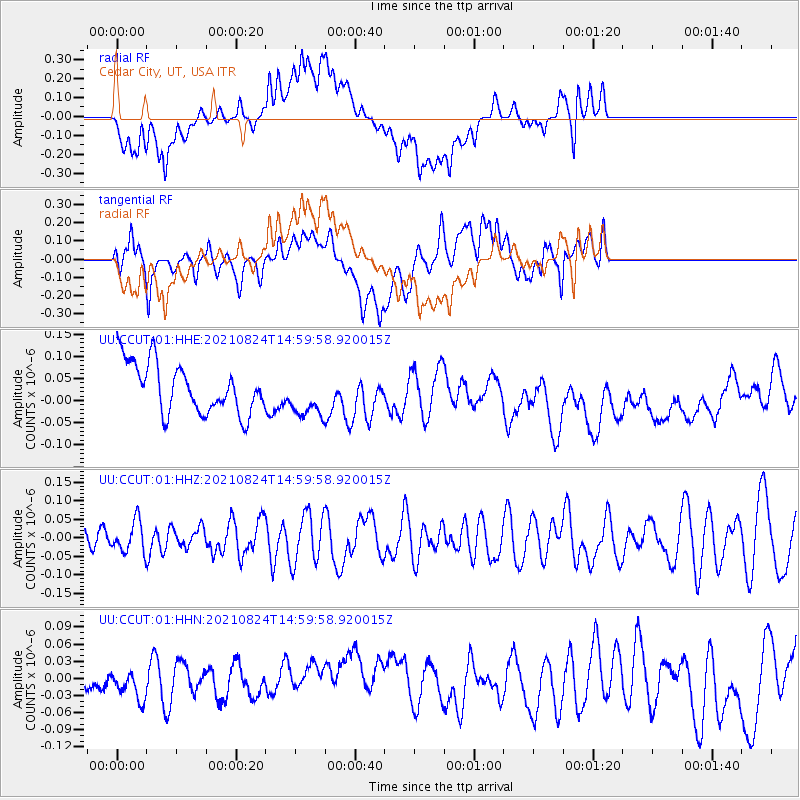
CCUT Cedar City, UT, USA - Earthquake Result Viewer
*The percent match for this event was below the threshold and hence no stack was calculated.
| Earthquake location: |
South Of Mariana Islands |
| Earthquake latitude/longitude: |
12.7/145.1 |
| Earthquake time(UTC): |
2021/08/24 (236) 14:47:25 GMT |
| Earthquake Depth: |
10 km |
| Earthquake Magnitude: |
5.5 Mww |
| Earthquake Catalog/Contributor: |
NEIC PDE/us |
|
| Network: |
UU University of Utah Regional Network |
| Station: |
CCUT Cedar City, UT, USA |
| Lat/Lon: |
37.55 N/113.36 W |
| Elevation: |
2127 m |
|
| Distance: |
91.3 deg |
| Az: |
51.163 deg |
| Baz: |
287.005 deg |
| Ray Param: |
$rayparam |
*The percent match for this event was below the threshold and hence was not used in the summary stack. |
|
| Radial Match: |
49.714687 % |
| Radial Bump: |
400 |
| Transverse Match: |
48.013138 % |
| Transverse Bump: |
400 |
| SOD ConfigId: |
25131211 |
| Insert Time: |
2021-09-07 14:59:20.406 +0000 |
| GWidth: |
2.5 |
| Max Bumps: |
400 |
| Tol: |
0.001 |
|
Signal To Noise
| Channel | StoN | STA | LTA |
| UU:CCUT:01:HHZ:20210824T14:59:58.920015Z | 0.8331592 | 4.1722505E-8 | 5.007747E-8 |
| UU:CCUT:01:HHN:20210824T14:59:58.920015Z | 0.72632384 | 2.3220434E-8 | 3.1969808E-8 |
| UU:CCUT:01:HHE:20210824T14:59:58.920015Z | 0.9019028 | 5.0718384E-8 | 5.6234867E-8 |
| Arrivals |
| Ps | |
| PpPs | |
| PsPs/PpSs | |


