You are here: Home > Network List > CN - Canadian National Seismograph Network Stations List
> Station INK INUVIK, NT > Earthquake Result Viewer
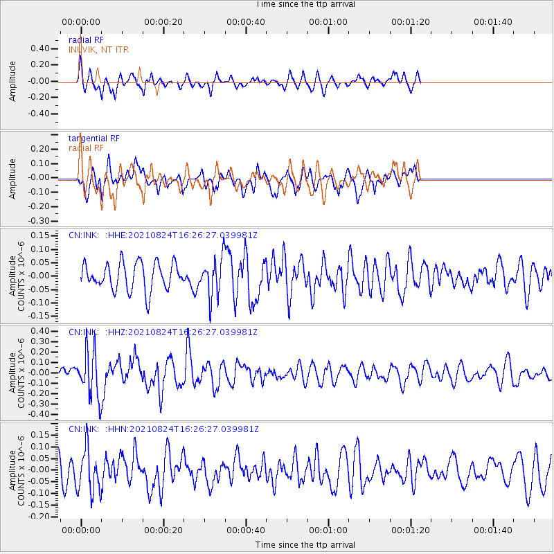
INK INUVIK, NT - Earthquake Result Viewer
*The percent match for this event was below the threshold and hence no stack was calculated.
| Earthquake location: |
Near Coast Of Guatemala |
| Earthquake latitude/longitude: |
13.4/-91.7 |
| Earthquake time(UTC): |
2021/08/24 (236) 16:16:44 GMT |
| Earthquake Depth: |
10 km |
| Earthquake Magnitude: |
5.6 Mww |
| Earthquake Catalog/Contributor: |
NEIC PDE/us |
|
| Network: |
CN Canadian National Seismograph Network |
| Station: |
INK INUVIK, NT |
| Lat/Lon: |
68.31 N/133.53 W |
| Elevation: |
44 m |
|
| Distance: |
61.1 deg |
| Az: |
343.551 deg |
| Baz: |
132.169 deg |
| Ray Param: |
$rayparam |
*The percent match for this event was below the threshold and hence was not used in the summary stack. |
|
| Radial Match: |
57.954697 % |
| Radial Bump: |
359 |
| Transverse Match: |
59.865612 % |
| Transverse Bump: |
387 |
| SOD ConfigId: |
25131211 |
| Insert Time: |
2021-09-07 16:24:09.118 +0000 |
| GWidth: |
2.5 |
| Max Bumps: |
400 |
| Tol: |
0.001 |
|
Signal To Noise
| Channel | StoN | STA | LTA |
| CN:INK: :HHZ:20210824T16:26:27.039981Z | 5.3210506 | 2.2003455E-7 | 4.135171E-8 |
| CN:INK: :HHN:20210824T16:26:27.039981Z | 1.9337683 | 9.574459E-8 | 4.9511925E-8 |
| CN:INK: :HHE:20210824T16:26:27.039981Z | 1.4400681 | 7.302399E-8 | 5.0708707E-8 |
| Arrivals |
| Ps | |
| PpPs | |
| PsPs/PpSs | |


