You are here: Home > Network List > US - United States National Seismic Network Stations List
> Station MSO Missoula, Montana, USA > Earthquake Result Viewer
MSO Missoula, Montana, USA - Earthquake Result Viewer
*The percent match for this event was below the threshold and hence no stack was calculated.
| Earthquake location: |
Near Coast Of Guatemala |
| Earthquake latitude/longitude: |
13.4/-91.7 |
| Earthquake time(UTC): |
2021/08/24 (236) 16:16:44 GMT |
| Earthquake Depth: |
10 km |
| Earthquake Magnitude: |
5.6 Mww |
| Earthquake Catalog/Contributor: |
NEIC PDE/us |
|
| Network: |
US United States National Seismic Network |
| Station: |
MSO Missoula, Montana, USA |
| Lat/Lon: |
46.83 N/113.94 W |
| Elevation: |
1264 m |
|
| Distance: |
38.2 deg |
| Az: |
335.159 deg |
| Baz: |
143.459 deg |
| Ray Param: |
$rayparam |
*The percent match for this event was below the threshold and hence was not used in the summary stack. |
|
| Radial Match: |
74.33284 % |
| Radial Bump: |
400 |
| Transverse Match: |
53.897655 % |
| Transverse Bump: |
400 |
| SOD ConfigId: |
25131211 |
| Insert Time: |
2021-09-07 16:31:13.464 +0000 |
| GWidth: |
2.5 |
| Max Bumps: |
400 |
| Tol: |
0.001 |
|
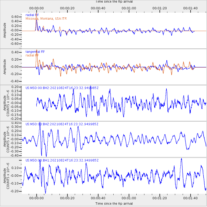
Signal To Noise
| Channel | StoN | STA | LTA |
| US:MSO:00:BHZ:20210824T16:23:32.949985Z | 3.3632796 | 1.9688883E-7 | 5.8540724E-8 |
| US:MSO:00:BH1:20210824T16:23:32.949985Z | 1.3021513 | 8.103523E-8 | 6.2231805E-8 |
| US:MSO:00:BH2:20210824T16:23:32.949985Z | 1.3542658 | 7.624457E-8 | 5.6299555E-8 |
| Arrivals |
| Ps | |
| PpPs | |
| PsPs/PpSs | |


