You are here: Home > Network List > IU - Global Seismograph Network (GSN - IRIS/USGS) Stations List
> Station CCM Cathedral Cave, Missouri, USA > Earthquake Result Viewer
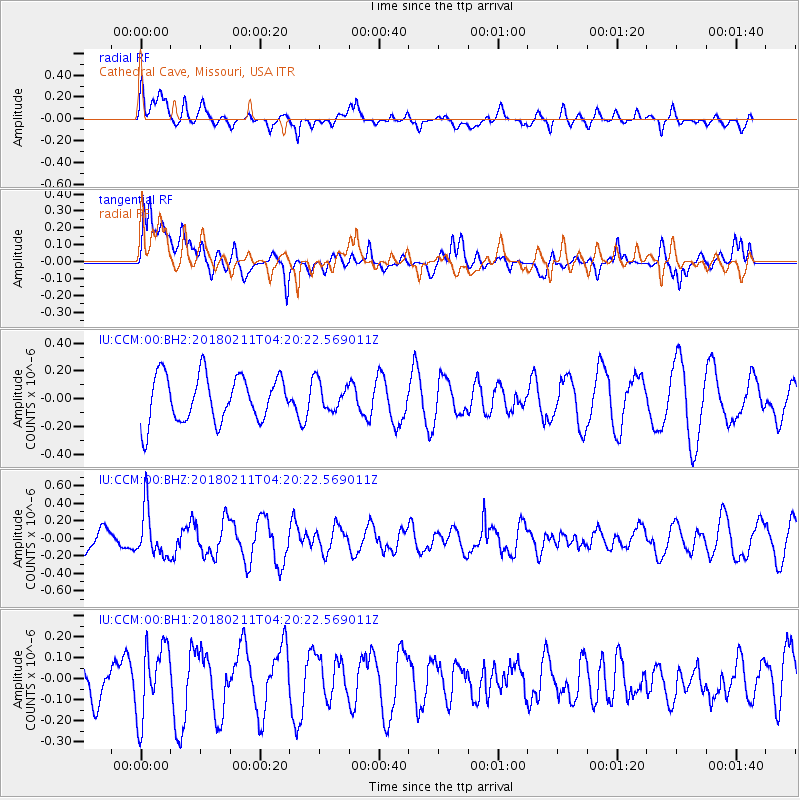
CCM Cathedral Cave, Missouri, USA - Earthquake Result Viewer
*The percent match for this event was below the threshold and hence no stack was calculated.
| Earthquake location: |
Near Coast Of Peru |
| Earthquake latitude/longitude: |
-16.7/-74.2 |
| Earthquake time(UTC): |
2018/02/11 (042) 04:11:09 GMT |
| Earthquake Depth: |
10 km |
| Earthquake Magnitude: |
5.4 Mww |
| Earthquake Catalog/Contributor: |
NEIC PDE/us |
|
| Network: |
IU Global Seismograph Network (GSN - IRIS/USGS) |
| Station: |
CCM Cathedral Cave, Missouri, USA |
| Lat/Lon: |
38.06 N/91.24 W |
| Elevation: |
222 m |
|
| Distance: |
56.8 deg |
| Az: |
343.903 deg |
| Baz: |
160.329 deg |
| Ray Param: |
$rayparam |
*The percent match for this event was below the threshold and hence was not used in the summary stack. |
|
| Radial Match: |
52.333458 % |
| Radial Bump: |
400 |
| Transverse Match: |
59.9808 % |
| Transverse Bump: |
400 |
| SOD ConfigId: |
2546091 |
| Insert Time: |
2018-02-25 04:13:13.203 +0000 |
| GWidth: |
2.5 |
| Max Bumps: |
400 |
| Tol: |
0.001 |
|
Signal To Noise
| Channel | StoN | STA | LTA |
| IU:CCM:00:BHZ:20180211T04:20:22.569011Z | 1.7964593 | 2.7642866E-7 | 1.5387415E-7 |
| IU:CCM:00:BH1:20180211T04:20:22.569011Z | 1.9841124 | 1.7014702E-7 | 8.575473E-8 |
| IU:CCM:00:BH2:20180211T04:20:22.569011Z | 0.6139083 | 1.0215328E-7 | 1.6639828E-7 |
| Arrivals |
| Ps | |
| PpPs | |
| PsPs/PpSs | |


