You are here: Home > Network List > TA - USArray Transportable Network (new EarthScope stations) Stations List
> Station TUL3 Leonard, OK, USA > Earthquake Result Viewer
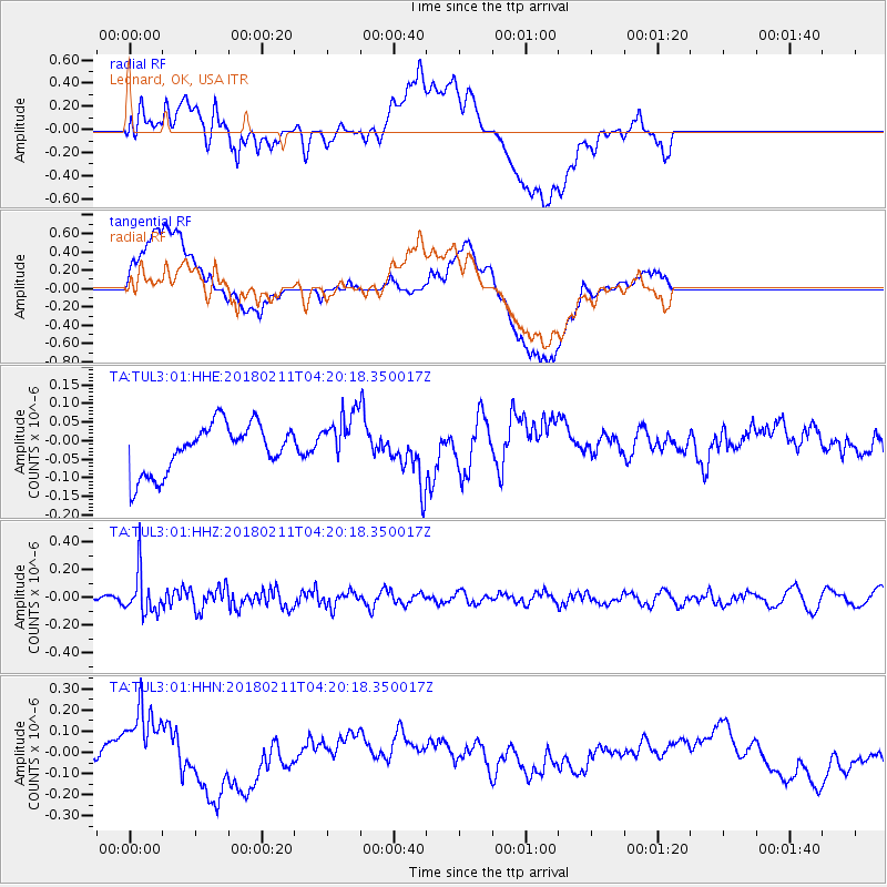
TUL3 Leonard, OK, USA - Earthquake Result Viewer
*The percent match for this event was below the threshold and hence no stack was calculated.
| Earthquake location: |
Near Coast Of Peru |
| Earthquake latitude/longitude: |
-16.7/-74.2 |
| Earthquake time(UTC): |
2018/02/11 (042) 04:11:09 GMT |
| Earthquake Depth: |
10 km |
| Earthquake Magnitude: |
5.4 Mww |
| Earthquake Catalog/Contributor: |
NEIC PDE/us |
|
| Network: |
TA USArray Transportable Network (new EarthScope stations) |
| Station: |
TUL3 Leonard, OK, USA |
| Lat/Lon: |
35.91 N/95.79 W |
| Elevation: |
265 m |
|
| Distance: |
56.2 deg |
| Az: |
338.886 deg |
| Baz: |
154.832 deg |
| Ray Param: |
$rayparam |
*The percent match for this event was below the threshold and hence was not used in the summary stack. |
|
| Radial Match: |
46.437023 % |
| Radial Bump: |
400 |
| Transverse Match: |
42.370995 % |
| Transverse Bump: |
400 |
| SOD ConfigId: |
2546091 |
| Insert Time: |
2018-02-25 04:14:21.926 +0000 |
| GWidth: |
2.5 |
| Max Bumps: |
400 |
| Tol: |
0.001 |
|
Signal To Noise
| Channel | StoN | STA | LTA |
| TA:TUL3:01:HHZ:20180211T04:20:18.350017Z | 4.517 | 1.471672E-7 | 3.2580736E-8 |
| TA:TUL3:01:HHN:20180211T04:20:18.350017Z | 3.4106069 | 1.8326274E-7 | 5.3733174E-8 |
| TA:TUL3:01:HHE:20180211T04:20:18.350017Z | 1.0999017 | 7.154278E-8 | 6.50447E-8 |
| Arrivals |
| Ps | |
| PpPs | |
| PsPs/PpSs | |


