You are here: Home > Network List > UW - Pacific Northwest Regional Seismic Network Stations List
> Station UMAT Pilot Rock, OR, USA > Earthquake Result Viewer
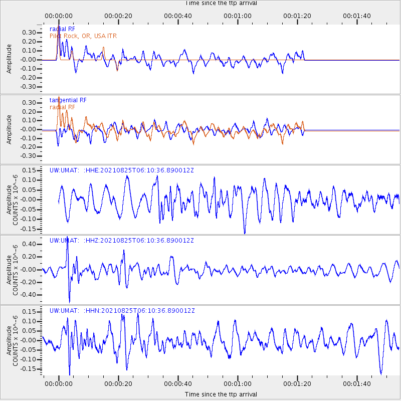
UMAT Pilot Rock, OR, USA - Earthquake Result Viewer
*The percent match for this event was below the threshold and hence no stack was calculated.
| Earthquake location: |
Kermadec Islands, New Zealand |
| Earthquake latitude/longitude: |
-29.7/-177.6 |
| Earthquake time(UTC): |
2021/08/25 (237) 05:58:03 GMT |
| Earthquake Depth: |
30 km |
| Earthquake Magnitude: |
5.7 mb |
| Earthquake Catalog/Contributor: |
NEIC PDE/us |
|
| Network: |
UW Pacific Northwest Regional Seismic Network |
| Station: |
UMAT Pilot Rock, OR, USA |
| Lat/Lon: |
45.29 N/118.96 W |
| Elevation: |
1318 m |
|
| Distance: |
91.7 deg |
| Az: |
37.072 deg |
| Baz: |
227.977 deg |
| Ray Param: |
$rayparam |
*The percent match for this event was below the threshold and hence was not used in the summary stack. |
|
| Radial Match: |
46.477043 % |
| Radial Bump: |
397 |
| Transverse Match: |
48.57379 % |
| Transverse Bump: |
400 |
| SOD ConfigId: |
25131211 |
| Insert Time: |
2021-09-08 06:15:53.116 +0000 |
| GWidth: |
2.5 |
| Max Bumps: |
400 |
| Tol: |
0.001 |
|
Signal To Noise
| Channel | StoN | STA | LTA |
| UW:UMAT: :HHZ:20210825T06:10:36.890012Z | 5.852311 | 2.038098E-7 | 3.4825526E-8 |
| UW:UMAT: :HHN:20210825T06:10:36.890012Z | 1.6599126 | 6.7916694E-8 | 4.0915825E-8 |
| UW:UMAT: :HHE:20210825T06:10:36.890012Z | 1.239654 | 6.738885E-8 | 5.4361013E-8 |
| Arrivals |
| Ps | |
| PpPs | |
| PsPs/PpSs | |


