You are here: Home > Network List > CI - Caltech Regional Seismic Network Stations List
> Station MPM Manuel Prospect Mine, California, USA > Earthquake Result Viewer
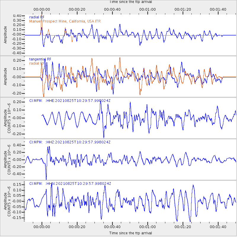
MPM Manuel Prospect Mine, California, USA - Earthquake Result Viewer
*The percent match for this event was below the threshold and hence no stack was calculated.
| Earthquake location: |
Southeast Of Honshu, Japan |
| Earthquake latitude/longitude: |
29.7/141.4 |
| Earthquake time(UTC): |
2021/08/25 (237) 10:18:16 GMT |
| Earthquake Depth: |
35 km |
| Earthquake Magnitude: |
5.3 Mww |
| Earthquake Catalog/Contributor: |
NEIC PDE/us |
|
| Network: |
CI Caltech Regional Seismic Network |
| Station: |
MPM Manuel Prospect Mine, California, USA |
| Lat/Lon: |
36.06 N/117.49 W |
| Elevation: |
185 m |
|
| Distance: |
81.2 deg |
| Az: |
53.585 deg |
| Baz: |
300.186 deg |
| Ray Param: |
$rayparam |
*The percent match for this event was below the threshold and hence was not used in the summary stack. |
|
| Radial Match: |
57.086617 % |
| Radial Bump: |
400 |
| Transverse Match: |
64.77694 % |
| Transverse Bump: |
400 |
| SOD ConfigId: |
25131211 |
| Insert Time: |
2021-09-08 10:27:30.206 +0000 |
| GWidth: |
2.5 |
| Max Bumps: |
400 |
| Tol: |
0.001 |
|
Signal To Noise
| Channel | StoN | STA | LTA |
| CI:MPM: :HHZ:20210825T10:29:57.998024Z | 3.3948655 | 2.1664279E-7 | 6.381484E-8 |
| CI:MPM: :HHN:20210825T10:29:57.998024Z | 1.1198771 | 6.209143E-8 | 5.544486E-8 |
| CI:MPM: :HHE:20210825T10:29:57.998024Z | 1.5368638 | 9.086674E-8 | 5.9124787E-8 |
| Arrivals |
| Ps | |
| PpPs | |
| PsPs/PpSs | |


