You are here: Home > Network List > CI - Caltech Regional Seismic Network Stations List
> Station MPP McPhearson Peak > Earthquake Result Viewer
MPP McPhearson Peak - Earthquake Result Viewer
*The percent match for this event was below the threshold and hence no stack was calculated.
| Earthquake location: |
Southeast Of Honshu, Japan |
| Earthquake latitude/longitude: |
29.7/141.4 |
| Earthquake time(UTC): |
2021/08/25 (237) 10:18:16 GMT |
| Earthquake Depth: |
35 km |
| Earthquake Magnitude: |
5.3 Mww |
| Earthquake Catalog/Contributor: |
NEIC PDE/us |
|
| Network: |
CI Caltech Regional Seismic Network |
| Station: |
MPP McPhearson Peak |
| Lat/Lon: |
34.89 N/119.81 W |
| Elevation: |
1739 m |
|
| Distance: |
80.1 deg |
| Az: |
55.564 deg |
| Baz: |
299.164 deg |
| Ray Param: |
$rayparam |
*The percent match for this event was below the threshold and hence was not used in the summary stack. |
|
| Radial Match: |
57.97497 % |
| Radial Bump: |
400 |
| Transverse Match: |
68.10823 % |
| Transverse Bump: |
400 |
| SOD ConfigId: |
25131211 |
| Insert Time: |
2021-09-08 10:27:31.653 +0000 |
| GWidth: |
2.5 |
| Max Bumps: |
400 |
| Tol: |
0.001 |
|
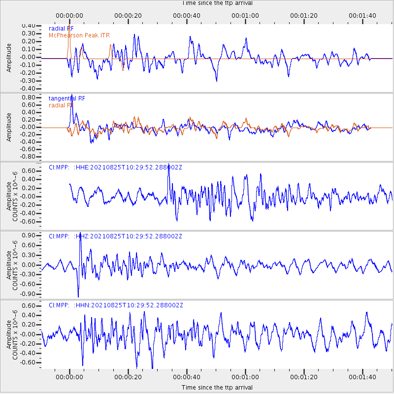
Signal To Noise
| Channel | StoN | STA | LTA |
| CI:MPP: :HHZ:20210825T10:29:52.288002Z | 4.098664 | 3.7128686E-7 | 9.058729E-8 |
| CI:MPP: :HHN:20210825T10:29:52.288002Z | 1.5432049 | 1.887116E-7 | 1.2228551E-7 |
| CI:MPP: :HHE:20210825T10:29:52.288002Z | 1.8303422 | 2.288601E-7 | 1.2503679E-7 |
| Arrivals |
| Ps | |
| PpPs | |
| PsPs/PpSs | |


