You are here: Home > Network List > US - United States National Seismic Network Stations List
> Station MIAR Mount Ida, Arkansas, USA > Earthquake Result Viewer
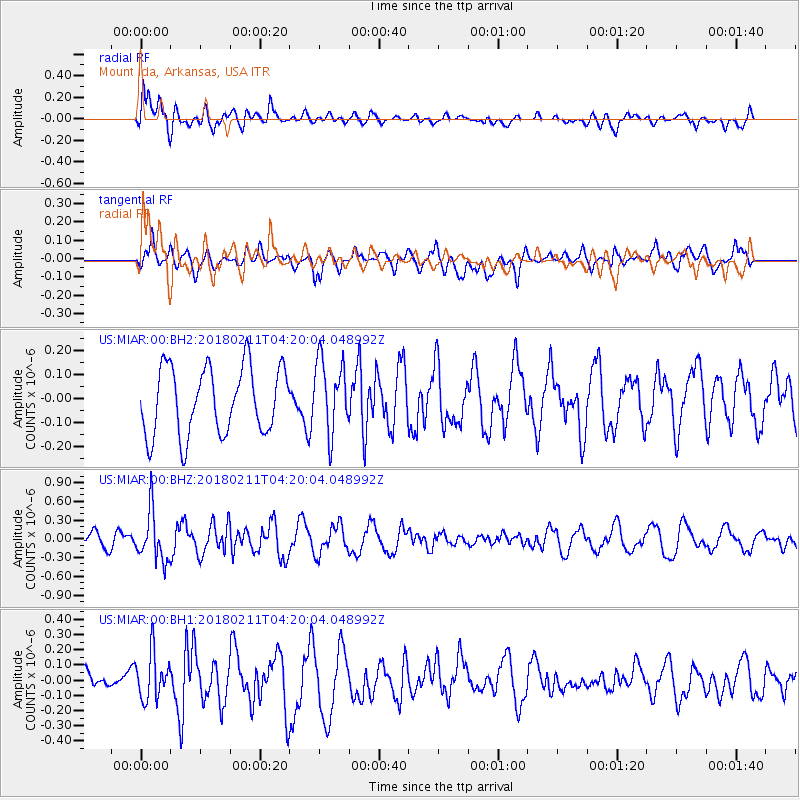
MIAR Mount Ida, Arkansas, USA - Earthquake Result Viewer
*The percent match for this event was below the threshold and hence no stack was calculated.
| Earthquake location: |
Near Coast Of Peru |
| Earthquake latitude/longitude: |
-16.7/-74.2 |
| Earthquake time(UTC): |
2018/02/11 (042) 04:11:09 GMT |
| Earthquake Depth: |
10 km |
| Earthquake Magnitude: |
5.4 Mww |
| Earthquake Catalog/Contributor: |
NEIC PDE/us |
|
| Network: |
US United States National Seismic Network |
| Station: |
MIAR Mount Ida, Arkansas, USA |
| Lat/Lon: |
34.55 N/93.58 W |
| Elevation: |
207 m |
|
| Distance: |
54.2 deg |
| Az: |
340.223 deg |
| Baz: |
156.868 deg |
| Ray Param: |
$rayparam |
*The percent match for this event was below the threshold and hence was not used in the summary stack. |
|
| Radial Match: |
55.539272 % |
| Radial Bump: |
400 |
| Transverse Match: |
64.32365 % |
| Transverse Bump: |
400 |
| SOD ConfigId: |
2546091 |
| Insert Time: |
2018-02-25 04:16:09.740 +0000 |
| GWidth: |
2.5 |
| Max Bumps: |
400 |
| Tol: |
0.001 |
|
Signal To Noise
| Channel | StoN | STA | LTA |
| US:MIAR:00:BHZ:20180211T04:20:04.048992Z | 3.5741718 | 3.9528538E-7 | 1.1059496E-7 |
| US:MIAR:00:BH1:20180211T04:20:04.048992Z | 2.05279 | 1.5224633E-7 | 7.416556E-8 |
| US:MIAR:00:BH2:20180211T04:20:04.048992Z | 1.0781375 | 1.5049683E-7 | 1.3958966E-7 |
| Arrivals |
| Ps | |
| PpPs | |
| PsPs/PpSs | |


