You are here: Home > Network List > US - United States National Seismic Network Stations List
> Station MNTX Cornudas Mountains, Texas, USA > Earthquake Result Viewer
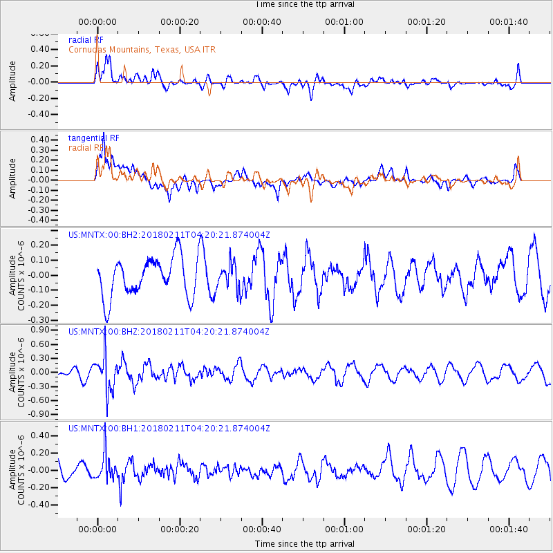
MNTX Cornudas Mountains, Texas, USA - Earthquake Result Viewer
*The percent match for this event was below the threshold and hence no stack was calculated.
| Earthquake location: |
Near Coast Of Peru |
| Earthquake latitude/longitude: |
-16.7/-74.2 |
| Earthquake time(UTC): |
2018/02/11 (042) 04:11:09 GMT |
| Earthquake Depth: |
10 km |
| Earthquake Magnitude: |
5.4 Mww |
| Earthquake Catalog/Contributor: |
NEIC PDE/us |
|
| Network: |
US United States National Seismic Network |
| Station: |
MNTX Cornudas Mountains, Texas, USA |
| Lat/Lon: |
31.70 N/105.38 W |
| Elevation: |
404 m |
|
| Distance: |
56.7 deg |
| Az: |
328.075 deg |
| Baz: |
143.518 deg |
| Ray Param: |
$rayparam |
*The percent match for this event was below the threshold and hence was not used in the summary stack. |
|
| Radial Match: |
77.78332 % |
| Radial Bump: |
400 |
| Transverse Match: |
73.56907 % |
| Transverse Bump: |
400 |
| SOD ConfigId: |
2546091 |
| Insert Time: |
2018-02-25 04:16:09.942 +0000 |
| GWidth: |
2.5 |
| Max Bumps: |
400 |
| Tol: |
0.001 |
|
Signal To Noise
| Channel | StoN | STA | LTA |
| US:MNTX:00:BHZ:20180211T04:20:21.874004Z | 3.6701615 | 3.79334E-7 | 1.03356214E-7 |
| US:MNTX:00:BH1:20180211T04:20:21.874004Z | 1.8823977 | 1.594609E-7 | 8.471159E-8 |
| US:MNTX:00:BH2:20180211T04:20:21.874004Z | 0.64626837 | 8.3899735E-8 | 1.2982183E-7 |
| Arrivals |
| Ps | |
| PpPs | |
| PsPs/PpSs | |


