You are here: Home > Network List > US - United States National Seismic Network Stations List
> Station AGMN Agassiz National Wildlife Refuge, Minnesota, USA > Earthquake Result Viewer
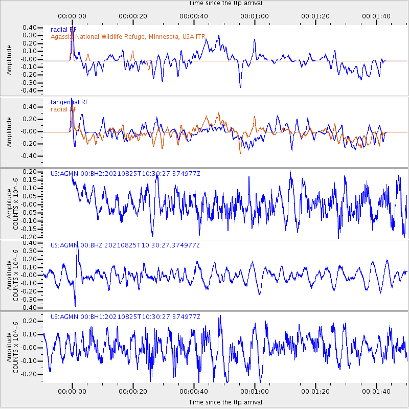
AGMN Agassiz National Wildlife Refuge, Minnesota, USA - Earthquake Result Viewer
*The percent match for this event was below the threshold and hence no stack was calculated.
| Earthquake location: |
Southeast Of Honshu, Japan |
| Earthquake latitude/longitude: |
29.7/141.4 |
| Earthquake time(UTC): |
2021/08/25 (237) 10:18:16 GMT |
| Earthquake Depth: |
35 km |
| Earthquake Magnitude: |
5.3 Mww |
| Earthquake Catalog/Contributor: |
NEIC PDE/us |
|
| Network: |
US United States National Seismic Network |
| Station: |
AGMN Agassiz National Wildlife Refuge, Minnesota, USA |
| Lat/Lon: |
48.30 N/95.86 W |
| Elevation: |
351 m |
|
| Distance: |
87.0 deg |
| Az: |
34.247 deg |
| Baz: |
312.818 deg |
| Ray Param: |
$rayparam |
*The percent match for this event was below the threshold and hence was not used in the summary stack. |
|
| Radial Match: |
43.180058 % |
| Radial Bump: |
400 |
| Transverse Match: |
60.348778 % |
| Transverse Bump: |
400 |
| SOD ConfigId: |
25131211 |
| Insert Time: |
2021-09-08 10:39:57.029 +0000 |
| GWidth: |
2.5 |
| Max Bumps: |
400 |
| Tol: |
0.001 |
|
Signal To Noise
| Channel | StoN | STA | LTA |
| US:AGMN:00:BHZ:20210825T10:30:27.374977Z | 2.6989574 | 1.6934874E-7 | 6.274598E-8 |
| US:AGMN:00:BH1:20210825T10:30:27.374977Z | 0.7300411 | 6.126127E-8 | 8.391482E-8 |
| US:AGMN:00:BH2:20210825T10:30:27.374977Z | 0.9299581 | 5.688743E-8 | 6.117203E-8 |
| Arrivals |
| Ps | |
| PpPs | |
| PsPs/PpSs | |


