You are here: Home > Network List > UW - Pacific Northwest Regional Seismic Network Stations List
> Station IRON Crane, OR, USA > Earthquake Result Viewer
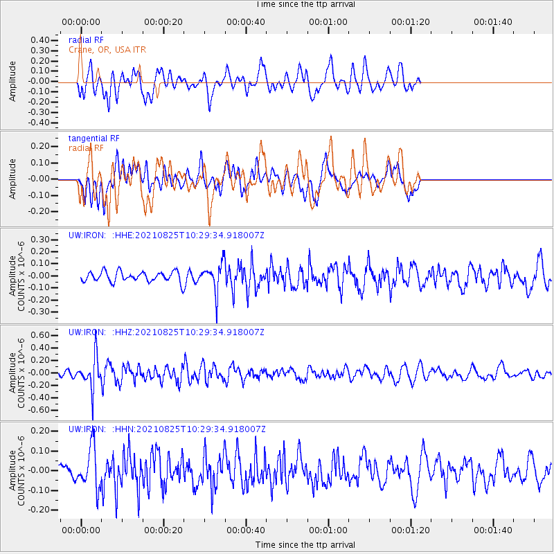
IRON Crane, OR, USA - Earthquake Result Viewer
*The percent match for this event was below the threshold and hence no stack was calculated.
| Earthquake location: |
Southeast Of Honshu, Japan |
| Earthquake latitude/longitude: |
29.7/141.4 |
| Earthquake time(UTC): |
2021/08/25 (237) 10:18:16 GMT |
| Earthquake Depth: |
35 km |
| Earthquake Magnitude: |
5.3 Mww |
| Earthquake Catalog/Contributor: |
NEIC PDE/us |
|
| Network: |
UW Pacific Northwest Regional Seismic Network |
| Station: |
IRON Crane, OR, USA |
| Lat/Lon: |
43.36 N/118.47 W |
| Elevation: |
1226 m |
|
| Distance: |
77.0 deg |
| Az: |
47.489 deg |
| Baz: |
298.4 deg |
| Ray Param: |
$rayparam |
*The percent match for this event was below the threshold and hence was not used in the summary stack. |
|
| Radial Match: |
62.42947 % |
| Radial Bump: |
400 |
| Transverse Match: |
62.551903 % |
| Transverse Bump: |
400 |
| SOD ConfigId: |
25131211 |
| Insert Time: |
2021-09-08 10:42:06.361 +0000 |
| GWidth: |
2.5 |
| Max Bumps: |
400 |
| Tol: |
0.001 |
|
Signal To Noise
| Channel | StoN | STA | LTA |
| UW:IRON: :HHZ:20210825T10:29:34.918007Z | 4.368254 | 2.6422316E-7 | 6.048713E-8 |
| UW:IRON: :HHN:20210825T10:29:34.918007Z | 1.6009738 | 1.0673154E-7 | 6.6666644E-8 |
| UW:IRON: :HHE:20210825T10:29:34.918007Z | 2.8419778 | 1.19071935E-7 | 4.189756E-8 |
| Arrivals |
| Ps | |
| PpPs | |
| PsPs/PpSs | |


