You are here: Home > Network List > GS - US Geological Survey Networks Stations List
> Station KAN10 Keim Farm > Earthquake Result Viewer
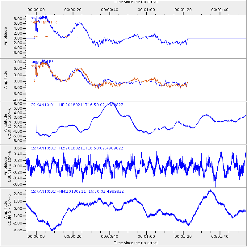
KAN10 Keim Farm - Earthquake Result Viewer
*The percent match for this event was below the threshold and hence no stack was calculated.
| Earthquake location: |
Fiji Islands Region |
| Earthquake latitude/longitude: |
-20.9/-179.1 |
| Earthquake time(UTC): |
2018/02/11 (042) 16:38:14 GMT |
| Earthquake Depth: |
631 km |
| Earthquake Magnitude: |
5.5 Mww |
| Earthquake Catalog/Contributor: |
NEIC PDE/us |
|
| Network: |
GS US Geological Survey Networks |
| Station: |
KAN10 Keim Farm |
| Lat/Lon: |
37.12 N/98.10 W |
| Elevation: |
417 m |
|
| Distance: |
95.6 deg |
| Az: |
52.493 deg |
| Baz: |
248.104 deg |
| Ray Param: |
$rayparam |
*The percent match for this event was below the threshold and hence was not used in the summary stack. |
|
| Radial Match: |
67.4594 % |
| Radial Bump: |
400 |
| Transverse Match: |
67.529106 % |
| Transverse Bump: |
400 |
| SOD ConfigId: |
2546091 |
| Insert Time: |
2018-02-25 17:37:30.867 +0000 |
| GWidth: |
2.5 |
| Max Bumps: |
400 |
| Tol: |
0.001 |
|
Signal To Noise
| Channel | StoN | STA | LTA |
| GS:KAN10:01:HHZ:20180211T16:50:02.498982Z | 0.7741701 | 1.4384622E-7 | 1.85807E-7 |
| GS:KAN10:01:HHN:20180211T16:50:02.498982Z | 3.5662615 | 2.7706722E-6 | 7.7691226E-7 |
| GS:KAN10:01:HHE:20180211T16:50:02.498982Z | 3.037551 | 5.078031E-6 | 1.6717518E-6 |
| Arrivals |
| Ps | |
| PpPs | |
| PsPs/PpSs | |


