You are here: Home > Network List > G - GEOSCOPE Stations List
> Station INU Inuyama, Japan > Earthquake Result Viewer
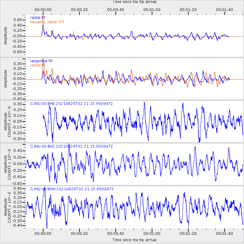
INU Inuyama, Japan - Earthquake Result Viewer
*The percent match for this event was below the threshold and hence no stack was calculated.
| Earthquake location: |
Minahassa Peninsula, Sulawesi |
| Earthquake latitude/longitude: |
-0.8/121.6 |
| Earthquake time(UTC): |
2021/08/26 (238) 02:14:21 GMT |
| Earthquake Depth: |
10 km |
| Earthquake Magnitude: |
5.5 mww |
| Earthquake Catalog/Contributor: |
NEIC PDE/us |
|
| Network: |
G GEOSCOPE |
| Station: |
INU Inuyama, Japan |
| Lat/Lon: |
35.35 N/137.03 E |
| Elevation: |
132 m |
|
| Distance: |
38.8 deg |
| Az: |
20.314 deg |
| Baz: |
205.128 deg |
| Ray Param: |
$rayparam |
*The percent match for this event was below the threshold and hence was not used in the summary stack. |
|
| Radial Match: |
61.911102 % |
| Radial Bump: |
400 |
| Transverse Match: |
57.20096 % |
| Transverse Bump: |
400 |
| SOD ConfigId: |
25131211 |
| Insert Time: |
2021-09-09 02:18:16.542 +0000 |
| GWidth: |
2.5 |
| Max Bumps: |
400 |
| Tol: |
0.001 |
|
Signal To Noise
| Channel | StoN | STA | LTA |
| G:INU:00:BHZ:20210826T02:21:15.660997Z | 2.441594 | 2.4306405E-7 | 9.955138E-8 |
| G:INU:00:BHN:20210826T02:21:15.660997Z | 2.189601 | 2.2496145E-7 | 1.0274085E-7 |
| G:INU:00:BHE:20210826T02:21:15.660997Z | 1.0502481 | 1.146529E-7 | 1.0916743E-7 |
| Arrivals |
| Ps | |
| PpPs | |
| PsPs/PpSs | |


