You are here: Home > Network List > IW - Intermountain West Stations List
> Station PLID Pearl Lake, Idaho, USA > Earthquake Result Viewer
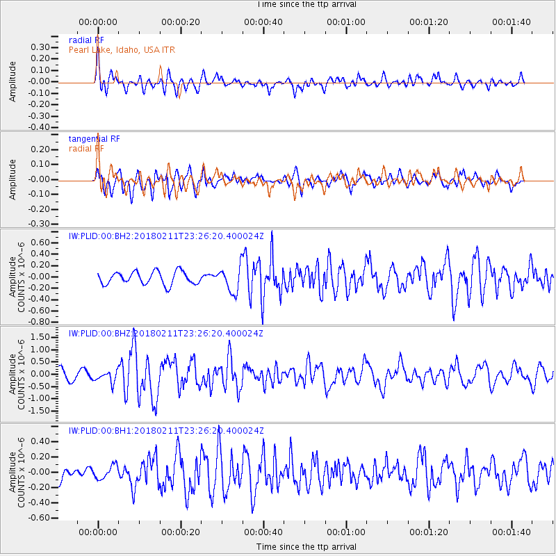
PLID Pearl Lake, Idaho, USA - Earthquake Result Viewer
*The percent match for this event was below the threshold and hence no stack was calculated.
| Earthquake location: |
South Of Mariana Islands |
| Earthquake latitude/longitude: |
13.8/146.5 |
| Earthquake time(UTC): |
2018/02/11 (042) 23:14:18 GMT |
| Earthquake Depth: |
42 km |
| Earthquake Magnitude: |
6.2 Mi |
| Earthquake Catalog/Contributor: |
NEIC PDE/pt |
|
| Network: |
IW Intermountain West |
| Station: |
PLID Pearl Lake, Idaho, USA |
| Lat/Lon: |
45.09 N/116.00 W |
| Elevation: |
2164 m |
|
| Distance: |
85.5 deg |
| Az: |
44.791 deg |
| Baz: |
284.972 deg |
| Ray Param: |
$rayparam |
*The percent match for this event was below the threshold and hence was not used in the summary stack. |
|
| Radial Match: |
69.069046 % |
| Radial Bump: |
400 |
| Transverse Match: |
67.800835 % |
| Transverse Bump: |
400 |
| SOD ConfigId: |
2546091 |
| Insert Time: |
2018-02-25 23:17:57.204 +0000 |
| GWidth: |
2.5 |
| Max Bumps: |
400 |
| Tol: |
0.001 |
|
Signal To Noise
| Channel | StoN | STA | LTA |
| IW:PLID:00:BHZ:20180211T23:26:20.400024Z | 1.3335854 | 2.3104353E-7 | 1.7324989E-7 |
| IW:PLID:00:BH1:20180211T23:26:20.400024Z | 0.83616257 | 8.8545065E-8 | 1.0589456E-7 |
| IW:PLID:00:BH2:20180211T23:26:20.400024Z | 2.068805 | 2.3175481E-7 | 1.1202352E-7 |
| Arrivals |
| Ps | |
| PpPs | |
| PsPs/PpSs | |


