You are here: Home > Network List > G - GEOSCOPE Stations List
> Station INU Inuyama, Japan > Earthquake Result Viewer
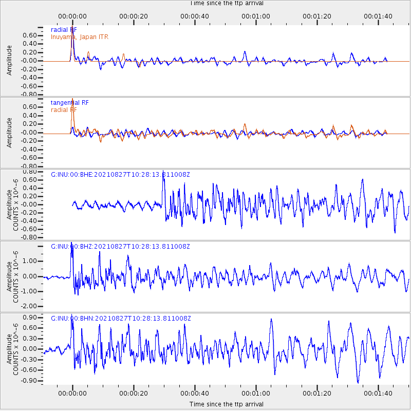
INU Inuyama, Japan - Earthquake Result Viewer
*The percent match for this event was below the threshold and hence no stack was calculated.
| Earthquake location: |
Mindanao, Philippines |
| Earthquake latitude/longitude: |
5.7/125.2 |
| Earthquake time(UTC): |
2021/08/27 (239) 10:22:26 GMT |
| Earthquake Depth: |
39 km |
| Earthquake Magnitude: |
5.6 Mww |
| Earthquake Catalog/Contributor: |
NEIC PDE/us |
|
| Network: |
G GEOSCOPE |
| Station: |
INU Inuyama, Japan |
| Lat/Lon: |
35.35 N/137.03 E |
| Elevation: |
132 m |
|
| Distance: |
31.4 deg |
| Az: |
18.678 deg |
| Baz: |
202.945 deg |
| Ray Param: |
$rayparam |
*The percent match for this event was below the threshold and hence was not used in the summary stack. |
|
| Radial Match: |
76.887314 % |
| Radial Bump: |
400 |
| Transverse Match: |
63.188595 % |
| Transverse Bump: |
400 |
| SOD ConfigId: |
25131211 |
| Insert Time: |
2021-09-10 10:31:21.114 +0000 |
| GWidth: |
2.5 |
| Max Bumps: |
400 |
| Tol: |
0.001 |
|
Signal To Noise
| Channel | StoN | STA | LTA |
| G:INU:00:BHZ:20210827T10:28:13.811008Z | 13.598954 | 8.319641E-7 | 6.117853E-8 |
| G:INU:00:BHN:20210827T10:28:13.811008Z | 4.1414733 | 3.93356E-7 | 9.4979725E-8 |
| G:INU:00:BHE:20210827T10:28:13.811008Z | 5.64946 | 3.2388309E-7 | 5.7329924E-8 |
| Arrivals |
| Ps | |
| PpPs | |
| PsPs/PpSs | |


