
ILAM YL.ILAM - Earthquake Result Viewer
| ||||||||||||||||||
| ||||||||||||||||||
| ||||||||||||||||||
|
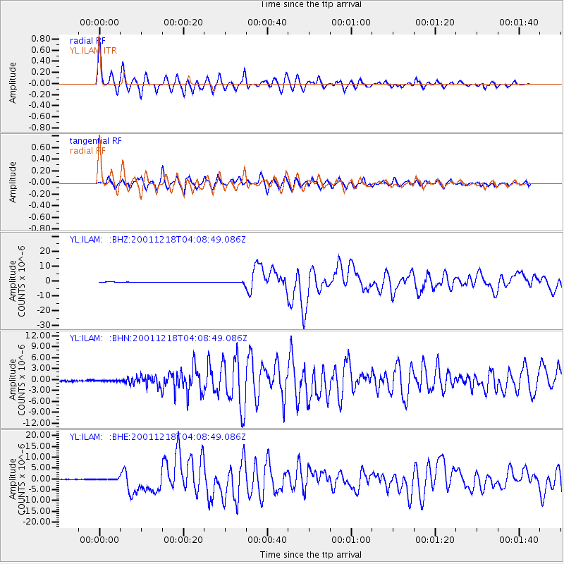
Signal To Noise
| Channel | StoN | STA | LTA |
| YL:ILAM: :BHN:20011218T04:08:49.086Z | 0.4769729 | 1.2199355E-7 | 2.557662E-7 |
| YL:ILAM: :BHE:20011218T04:08:49.086Z | 3.636333 | 4.2240848E-7 | 1.1616331E-7 |
| YL:ILAM: :BHZ:20011218T04:08:49.086Z | 6.666482 | 7.404962E-7 | 1.11077505E-7 |
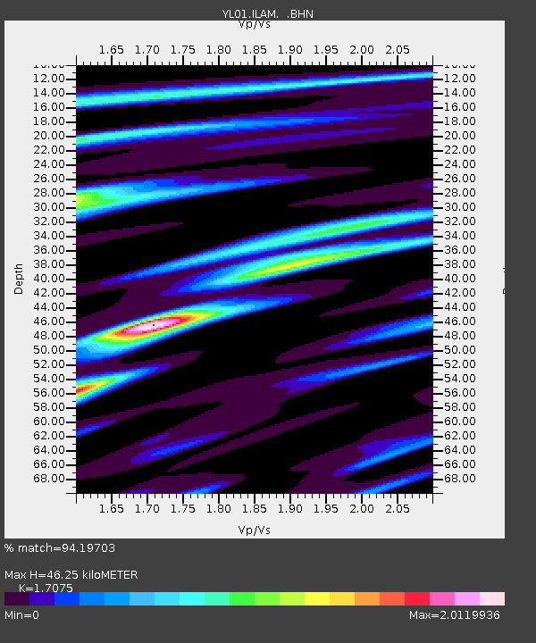
| Arrivals | |
| Ps | 5.7 SECOND |
| PpPs | 19 SECOND |
| PsPs/PpSs | 24 SECOND |

