ILAM YL.ILAM - Earthquake Result Viewer
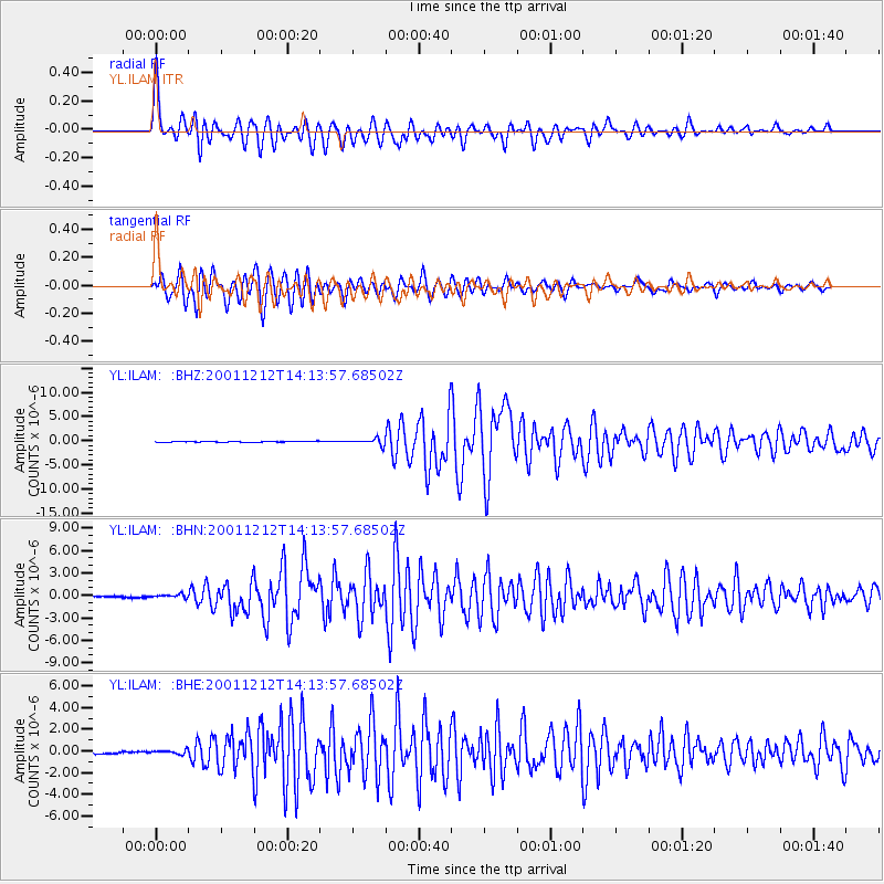
Earthquake location: South Of Australia
Earthquake latitude/longitude: -42.8/124.7
Earthquake time(UTC): 2001/12/12 (346) 14:02:35 GMT
Earthquake Depth: 10 km
Earthquake Magnitude: 6.5 MB, 6.7 MS, 7.1 MW, 7.0 MW
Earthquake Catalog/Contributor: WHDF/NEIC
Network: YL Himalayan Nepal Tibet Experiment
Station: ILAM YL.ILAM
Lat/Lon: 26.91 N/87.92 E
Elevation: 1181 m
Distance: 77.2 deg
Az: 326.765 deg
Baz: 153.15 deg
Ray Param: 0.05048316
Estimated Moho Depth: 55.5 km
Estimated Crust Vp/Vs: 1.64
Assumed Crust Vp: 6.236 km/s
Estimated Crust Vs: 3.808 km/s
Estimated Crust Poisson's Ratio: 0.20
Radial Match: 93.853294 %
Radial Bump: 400
Transverse Match: 89.732254 %
Transverse Bump: 400
SOD ConfigId: 16820
Insert Time: 2010-02-26 15:55:35.126 +0000
GWidth: 2.5
Max Bumps: 400
Tol: 0.001

Signal To Noise

ChannelStoNSTALTA
YL:ILAM: :BHN:20011212T14:13:57.68502Z2.10617952.2547404E-71.0705357E-7
YL:ILAM: :BHE:20011212T14:13:57.68502Z2.0103521.8799749E-79.351471E-8
YL:ILAM: :BHZ:20011212T14:13:57.68502Z7.11440476.523879E-79.1699576E-8
Arrivals
Ps5.9 SECOND
PpPs23 SECOND
PsPs/PpSs29 SECOND