You are here: Home > Network List > AV - Alaska Volcano Observatory Stations List
> Station AMKA Regional Station, Amchitka Island, Alaska > Earthquake Result Viewer
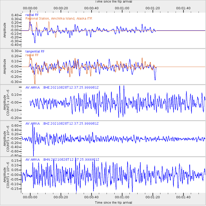
AMKA Regional Station, Amchitka Island, Alaska - Earthquake Result Viewer
*The percent match for this event was below the threshold and hence no stack was calculated.
| Earthquake location: |
Irian Jaya, Indonesia |
| Earthquake latitude/longitude: |
-3.5/140.1 |
| Earthquake time(UTC): |
2021/08/28 (240) 12:27:23 GMT |
| Earthquake Depth: |
10 km |
| Earthquake Magnitude: |
5.5 mww |
| Earthquake Catalog/Contributor: |
NEIC PDE/us |
|
| Network: |
AV Alaska Volcano Observatory |
| Station: |
AMKA Regional Station, Amchitka Island, Alaska |
| Lat/Lon: |
51.38 N/179.30 E |
| Elevation: |
116 m |
|
| Distance: |
64.1 deg |
| Az: |
26.122 deg |
| Baz: |
224.523 deg |
| Ray Param: |
$rayparam |
*The percent match for this event was below the threshold and hence was not used in the summary stack. |
|
| Radial Match: |
71.51236 % |
| Radial Bump: |
400 |
| Transverse Match: |
58.588272 % |
| Transverse Bump: |
400 |
| SOD ConfigId: |
25131211 |
| Insert Time: |
2021-09-11 12:30:27.763 +0000 |
| GWidth: |
2.5 |
| Max Bumps: |
400 |
| Tol: |
0.001 |
|
Signal To Noise
| Channel | StoN | STA | LTA |
| AV:AMKA: :BHZ:20210828T12:37:25.999981Z | 6.848886 | 2.7150045E-7 | 3.964155E-8 |
| AV:AMKA: :BHN:20210828T12:37:25.999981Z | 1.349396 | 5.279666E-8 | 3.9126142E-8 |
| AV:AMKA: :BHE:20210828T12:37:25.999981Z | 1.8372495 | 6.191421E-8 | 3.36994E-8 |
| Arrivals |
| Ps | |
| PpPs | |
| PsPs/PpSs | |


