You are here: Home > Network List > G - GEOSCOPE Stations List
> Station MPG Montagne des Peres, French Guyana > Earthquake Result Viewer
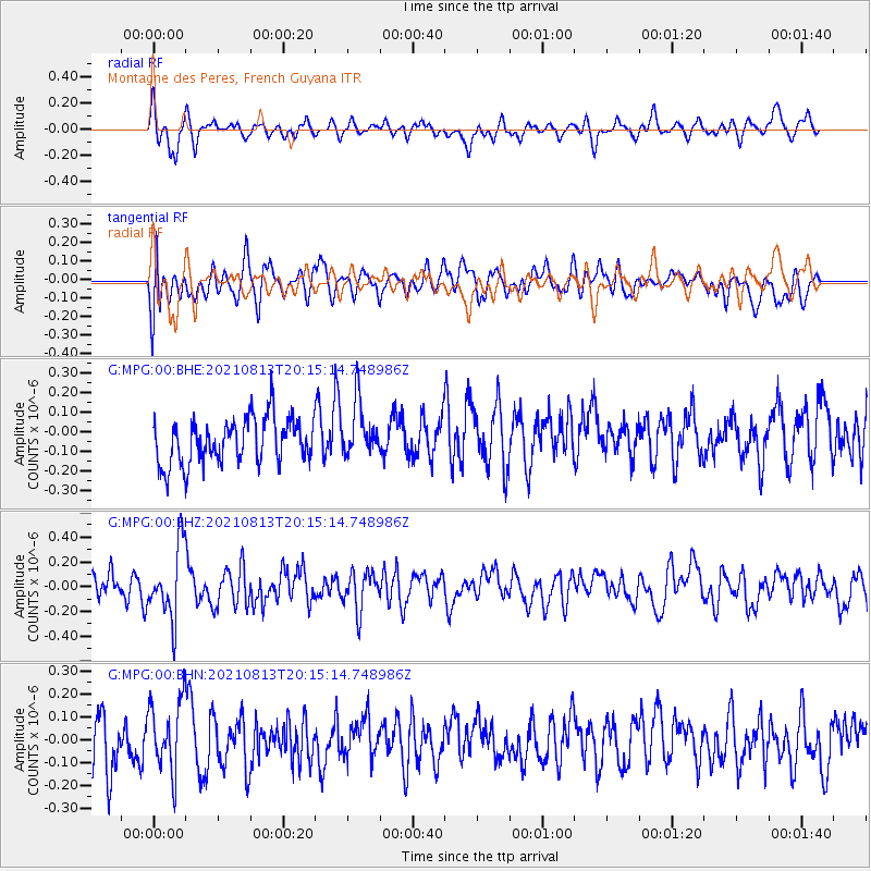
MPG Montagne des Peres, French Guyana - Earthquake Result Viewer
*The percent match for this event was below the threshold and hence no stack was calculated.
| Earthquake location: |
South Sandwich Islands Region |
| Earthquake latitude/longitude: |
-57.8/-24.0 |
| Earthquake time(UTC): |
2021/08/13 (225) 20:04:53 GMT |
| Earthquake Depth: |
10 km |
| Earthquake Magnitude: |
5.5 Mww |
| Earthquake Catalog/Contributor: |
NEIC PDE/us |
|
| Network: |
G GEOSCOPE |
| Station: |
MPG Montagne des Peres, French Guyana |
| Lat/Lon: |
5.11 N/52.64 W |
| Elevation: |
147 m |
|
| Distance: |
66.9 deg |
| Az: |
328.705 deg |
| Baz: |
163.799 deg |
| Ray Param: |
$rayparam |
*The percent match for this event was below the threshold and hence was not used in the summary stack. |
|
| Radial Match: |
57.646854 % |
| Radial Bump: |
400 |
| Transverse Match: |
55.727997 % |
| Transverse Bump: |
400 |
| SOD ConfigId: |
25131211 |
| Insert Time: |
2021-09-11 17:48:11.901 +0000 |
| GWidth: |
2.5 |
| Max Bumps: |
400 |
| Tol: |
0.001 |
|
Signal To Noise
| Channel | StoN | STA | LTA |
| G:MPG:00:BHZ:20210813T20:15:14.748986Z | 2.8168154 | 2.8848623E-7 | 1.0241574E-7 |
| G:MPG:00:BHN:20210813T20:15:14.748986Z | 1.3503145 | 1.558956E-7 | 1.1545133E-7 |
| G:MPG:00:BHE:20210813T20:15:14.748986Z | 1.173905 | 1.3571864E-7 | 1.1561296E-7 |
| Arrivals |
| Ps | |
| PpPs | |
| PsPs/PpSs | |


