You are here: Home > Network List > G - GEOSCOPE Stations List
> Station MPG Montagne des Peres, French Guyana > Earthquake Result Viewer
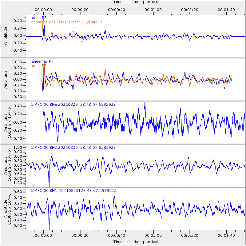
MPG Montagne des Peres, French Guyana - Earthquake Result Viewer
*The percent match for this event was below the threshold and hence no stack was calculated.
| Earthquake location: |
South Sandwich Islands Region |
| Earthquake latitude/longitude: |
-58.1/-23.5 |
| Earthquake time(UTC): |
2021/08/29 (241) 23:32:44 GMT |
| Earthquake Depth: |
10 km |
| Earthquake Magnitude: |
5.3 Mww |
| Earthquake Catalog/Contributor: |
NEIC PDE/us |
|
| Network: |
G GEOSCOPE |
| Station: |
MPG Montagne des Peres, French Guyana |
| Lat/Lon: |
5.11 N/52.64 W |
| Elevation: |
147 m |
|
| Distance: |
67.2 deg |
| Az: |
328.293 deg |
| Baz: |
163.729 deg |
| Ray Param: |
$rayparam |
*The percent match for this event was below the threshold and hence was not used in the summary stack. |
|
| Radial Match: |
47.759586 % |
| Radial Bump: |
400 |
| Transverse Match: |
57.253075 % |
| Transverse Bump: |
400 |
| SOD ConfigId: |
25131211 |
| Insert Time: |
2021-09-12 23:34:50.746 +0000 |
| GWidth: |
2.5 |
| Max Bumps: |
400 |
| Tol: |
0.001 |
|
Signal To Noise
| Channel | StoN | STA | LTA |
| G:MPG:00:BHZ:20210829T23:43:07.698992Z | 2.026157 | 4.3481725E-7 | 2.1460195E-7 |
| G:MPG:00:BHN:20210829T23:43:07.698992Z | 1.6495513 | 2.334331E-7 | 1.415131E-7 |
| G:MPG:00:BHE:20210829T23:43:07.698992Z | 0.72235906 | 1.0541434E-7 | 1.4593066E-7 |
| Arrivals |
| Ps | |
| PpPs | |
| PsPs/PpSs | |


