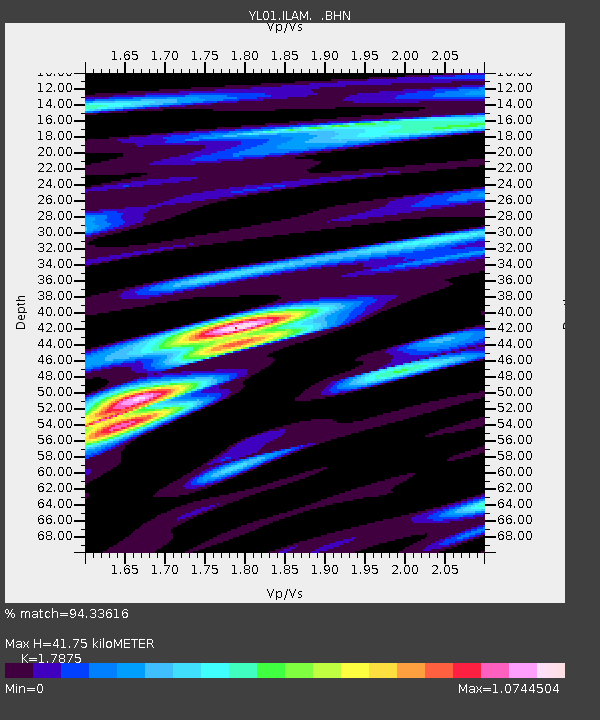
ILAM YL.ILAM - Earthquake Result Viewer
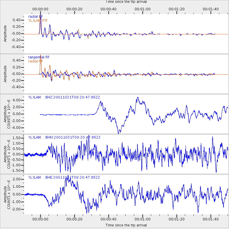
Earthquake location: New Britain Region, P.N.G.
Earthquake latitude/longitude: -5.9/150.2
Earthquake time(UTC): 2001/10/31 (304) 09:10:20 GMT
Earthquake Depth: 33 km
Earthquake Magnitude: 5.9 MB, 6.9 MS, 6.9 MW, 6.9 MW
Earthquake Catalog/Contributor: WHDF/NEIC
Network: YL Himalayan Nepal Tibet Experiment
Station: ILAM YL.ILAM
Lat/Lon: 26.91 N/87.92 E
Elevation: 1181 m
Distance: 68.5 deg
Az: 301.813 deg
Baz: 108.797 deg
Ray Param: 0.05624077
Estimated Moho Depth: 41.75 km
Estimated Crust Vp/Vs: 1.79
Assumed Crust Vp: 6.236 km/s
Estimated Crust Vs: 3.489 km/s
Estimated Crust Poisson's Ratio: 0.27
Radial Match: 94.33616 %
Radial Bump: 400
Transverse Match: 77.59231 %
Transverse Bump: 400
SOD ConfigId: 16820
Insert Time: 2010-02-26 15:55:44.092 +0000
GWidth: 2.5
Max Bumps: 400
Tol: 0.001

Signal To Noise

ChannelStoNSTALTA
YL:ILAM: :BHN:20011031T09:20:47.862Z2.8569992.2687034E-77.940862E-8
YL:ILAM: :BHE:20011031T09:20:47.862Z6.4510784.4869503E-76.9553494E-8
YL:ILAM: :BHZ:20011031T09:20:47.862Z23.3265111.2209948E-65.234365E-8
Arrivals
Ps5.5 SECOND
PpPs18 SECOND
PsPs/PpSs23 SECOND