
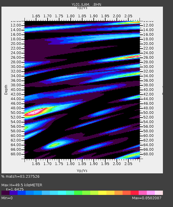
ILAM YL.ILAM - Earthquake Result Viewer
| ||||||||||||||||||
| ||||||||||||||||||
| ||||||||||||||||||
|
Signal To Noise
| Channel | StoN | STA | LTA |
| YL:ILAM: :BHN:20011026T23:18:15.160022Z | 0.59124106 | 5.0305854E-8 | 8.508518E-8 |
| YL:ILAM: :BHE:20011026T23:18:15.160022Z | 0.8927804 | 7.923704E-8 | 8.875311E-8 |
| YL:ILAM: :BHZ:20011026T23:18:15.160022Z | 4.810525 | 3.240387E-7 | 6.736036E-8 |
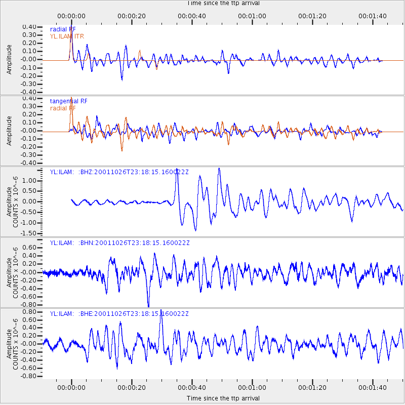
| Arrivals | |
| Ps | 5.2 SECOND |
| PpPs | 21 SECOND |
| PsPs/PpSs | 26 SECOND |

