ILAM YL.ILAM - Earthquake Result Viewer
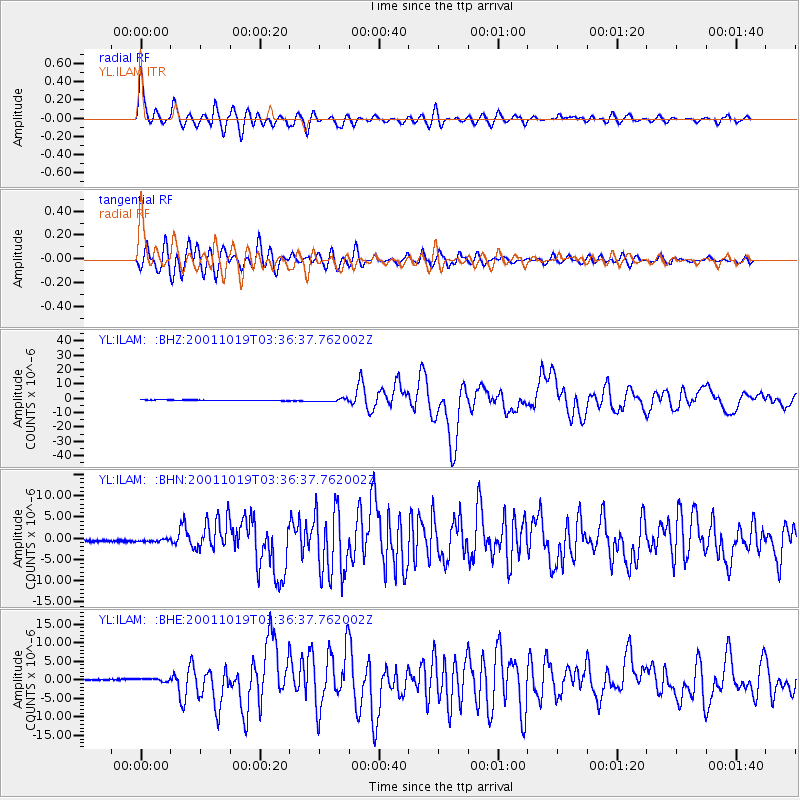
Earthquake location: Banda Sea
Earthquake latitude/longitude: -4.1/123.9
Earthquake time(UTC): 2001/10/19 (292) 03:28:44 GMT
Earthquake Depth: 33 km
Earthquake Magnitude: 6.3 MB, 7.3 MS, 7.5 MW, 7.4 MW
Earthquake Catalog/Contributor: WHDF/NEIC
Network: YL Himalayan Nepal Tibet Experiment
Station: ILAM YL.ILAM
Lat/Lon: 26.91 N/87.92 E
Elevation: 1181 m
Distance: 46.5 deg
Az: 313.643 deg
Baz: 126.063 deg
Ray Param: 0.070561394
Estimated Moho Depth: 34.5 km
Estimated Crust Vp/Vs: 1.96
Assumed Crust Vp: 6.236 km/s
Estimated Crust Vs: 3.186 km/s
Estimated Crust Poisson's Ratio: 0.32
Radial Match: 90.017876 %
Radial Bump: 400
Transverse Match: 89.63248 %
Transverse Bump: 400
SOD ConfigId: 16820
Insert Time: 2010-02-26 15:55:47.656 +0000
GWidth: 2.5
Max Bumps: 400
Tol: 0.001

Signal To Noise

ChannelStoNSTALTA
YL:ILAM: :BHN:20011019T03:36:37.762002Z1.6404063.0320865E-71.8483756E-7
YL:ILAM: :BHE:20011019T03:36:37.762002Z2.75200464.3363417E-71.575703E-7
YL:ILAM: :BHZ:20011019T03:36:37.762002Z3.65615568.691496E-72.3772226E-7
Arrivals
Ps5.6 SECOND
PpPs16 SECOND
PsPs/PpSs21 SECOND