You are here: Home > Network List > US - United States National Seismic Network Stations List
> Station OGNE Ogallala, Nebraska, USA > Earthquake Result Viewer
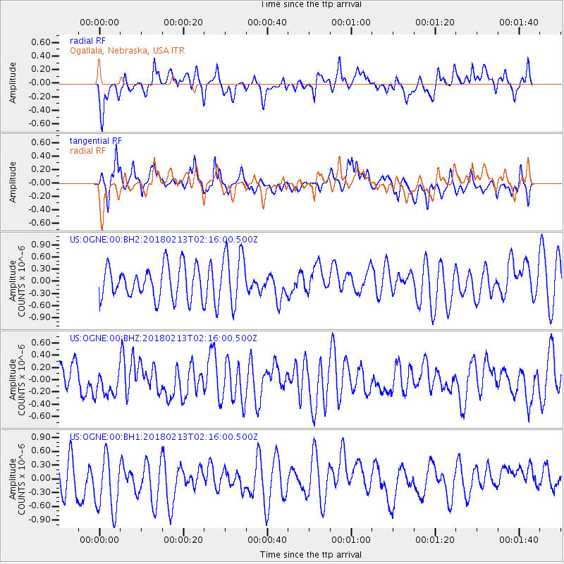
OGNE Ogallala, Nebraska, USA - Earthquake Result Viewer
*The percent match for this event was below the threshold and hence no stack was calculated.
| Earthquake location: |
South Of Mariana Islands |
| Earthquake latitude/longitude: |
13.8/146.7 |
| Earthquake time(UTC): |
2018/02/13 (044) 02:03:03 GMT |
| Earthquake Depth: |
10 km |
| Earthquake Magnitude: |
5.7 mww |
| Earthquake Catalog/Contributor: |
NEIC PDE/pt |
|
| Network: |
US United States National Seismic Network |
| Station: |
OGNE Ogallala, Nebraska, USA |
| Lat/Lon: |
40.95 N/102.03 W |
| Elevation: |
1054 m |
|
| Distance: |
96.4 deg |
| Az: |
45.253 deg |
| Baz: |
294.4 deg |
| Ray Param: |
$rayparam |
*The percent match for this event was below the threshold and hence was not used in the summary stack. |
|
| Radial Match: |
43.323387 % |
| Radial Bump: |
400 |
| Transverse Match: |
56.00244 % |
| Transverse Bump: |
400 |
| SOD ConfigId: |
2546091 |
| Insert Time: |
2018-02-27 02:05:21.538 +0000 |
| GWidth: |
2.5 |
| Max Bumps: |
400 |
| Tol: |
0.001 |
|
Signal To Noise
| Channel | StoN | STA | LTA |
| US:OGNE:00:BHZ:20180213T02:16:00.500Z | 0.8580898 | 2.0781208E-7 | 2.4217988E-7 |
| US:OGNE:00:BH1:20180213T02:16:00.500Z | 1.7194736 | 6.8368547E-7 | 3.9761323E-7 |
| US:OGNE:00:BH2:20180213T02:16:00.500Z | 1.690638 | 6.6239784E-7 | 3.9180347E-7 |
| Arrivals |
| Ps | |
| PpPs | |
| PsPs/PpSs | |


