You are here: Home > Network List > CI - Caltech Regional Seismic Network Stations List
> Station MPP McPhearson Peak > Earthquake Result Viewer
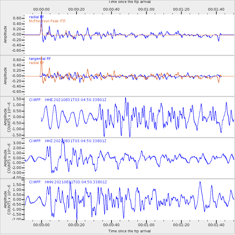
MPP McPhearson Peak - Earthquake Result Viewer
*The percent match for this event was below the threshold and hence no stack was calculated.
| Earthquake location: |
Kermadec Islands, New Zealand |
| Earthquake latitude/longitude: |
-30.0/-177.5 |
| Earthquake time(UTC): |
2021/08/31 (243) 02:52:49 GMT |
| Earthquake Depth: |
10 km |
| Earthquake Magnitude: |
6.3 mww |
| Earthquake Catalog/Contributor: |
NEIC PDE/us |
|
| Network: |
CI Caltech Regional Seismic Network |
| Station: |
MPP McPhearson Peak |
| Lat/Lon: |
34.89 N/119.81 W |
| Elevation: |
1739 m |
|
| Distance: |
84.4 deg |
| Az: |
44.287 deg |
| Baz: |
227.487 deg |
| Ray Param: |
$rayparam |
*The percent match for this event was below the threshold and hence was not used in the summary stack. |
|
| Radial Match: |
76.00105 % |
| Radial Bump: |
400 |
| Transverse Match: |
63.367573 % |
| Transverse Bump: |
400 |
| SOD ConfigId: |
25131211 |
| Insert Time: |
2021-09-14 03:19:14.605 +0000 |
| GWidth: |
2.5 |
| Max Bumps: |
400 |
| Tol: |
0.001 |
|
Signal To Noise
| Channel | StoN | STA | LTA |
| CI:MPP: :HHZ:20210831T03:04:50.33801Z | 2.7023783 | 1.027472E-6 | 3.8021028E-7 |
| CI:MPP: :HHN:20210831T03:04:50.33801Z | 1.0933466 | 6.4931595E-7 | 5.9387935E-7 |
| CI:MPP: :HHE:20210831T03:04:50.33801Z | 0.7850985 | 4.1102456E-7 | 5.235325E-7 |
| Arrivals |
| Ps | |
| PpPs | |
| PsPs/PpSs | |


